Muir Pass
| Muir Pass | |
|---|---|
 | |
| Elevation | 11,955 ft (3,644 m) |
| Traversed by | John Muir Trail |
| Location | Fresno County, California, United States |
| Range | Sierra Nevada |
| Coordinates | 37°06′42″N 118°40′14″W / 37.11167°N 118.67056°WCoordinates: 37°06′42″N 118°40′14″W / 37.11167°N 118.67056°W [1] |
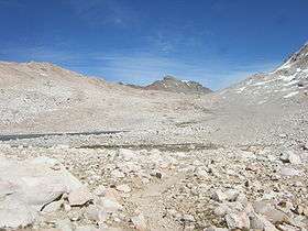
Muir Pass is a mountain pass in the Sierra Nevada of California, United States, in Kings Canyon National Park. It is named for John Muir.[1]
The pass is near the midway point of the John Muir Trail, which traverses the pass. It crosses the Goddard Divide between Mount Solomons and Mount Warlow,[1] at an elevation of 11,955 feet (3,644 m). The Muir Hut, built by the Sierra Club, is at the summit of the pass.
Notes
- 1 2 3 "Muir Pass". Geographic Names Information System. United States Geological Survey. Retrieved 2008-09-12.
This article is issued from
Wikipedia.
The text is licensed under Creative Commons - Attribution - Sharealike.
Additional terms may apply for the media files.