Mueang Phrae District
| Mueang Phrae เมืองแพร่ | |
|---|---|
| Amphoe | |
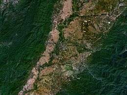 NASA picture of Mueang Phrae District | |
 Amphoe location in Phrae Province | |
| Coordinates: 18°8′44″N 100°8′29″E / 18.14556°N 100.14139°ECoordinates: 18°8′44″N 100°8′29″E / 18.14556°N 100.14139°E | |
| Country | Thailand |
| Province | Phrae |
| Area | |
| • Total | 756.1 km2 (291.9 sq mi) |
| Population (2005) | |
| • Total | 123,811 |
| • Density | 163.7/km2 (424/sq mi) |
| Time zone | UTC+7 (ICT) |
| Postal code | 54000 |
| Geocode | 5401 |
Mueang Phrae (Thai: เมืองแพร่, pronounced [mɯ̄a̯ŋ pʰrɛ̂ː]) is the capital district (amphoe mueang) of Phrae Province, northern Thailand.
Geography
Neighboring districts are (from the southwest clockwise) Sung Men, Long, Nong Muang Khai, and Rong Kwang of Phrae Province, Na Muen of Nan Province and Tha Pla of Uttaradit Province.
The Phi Pan Nam Range dominates the landscape of the district.
Administration
The district is divided into 20 sub-districts (tambon), which are further subdivided into 157 villages (muban). Phrae itself is a town (thesaban mueang) and covers tambon Nai Wiang. There are three more townships (thesaban tambon): Thung Hong and Mae Lai both cover tambons of the same name, Cho Hae covers tambon Cho Hae and parts of Padaeng. There are a further 15 tambon administrative organizations (TAO).
| No. | Name | Thai name | Villages | Pop. | |
|---|---|---|---|---|---|
| 1. | Nai Wiang | ในเวียง | - | 17,971 | |
| 2. | Na Chak | นาจักร | 8 | 6,381 | |
| 3. | Nam Cham | น้ำชำ | 4 | 1,769 | |
| 4. | Pa Daeng | ป่าแดง | 10 | 5,147 | |
| 5. | Thung Hong | ทุ่งโฮ้ง | 7 | 6,397 | |
| 6. | Mueang Mo | เหมืองหม้อ | 12 | 9,301 | |
| 7. | Wang Thong | วังธง | 5 | 2,683 | |
| 8. | Mae Lai | แม่หล่าย | 6 | 4,662 | |
| 9. | Huai Ma | ห้วยม้า | 14 | 6,964 | |
| 10. | Pa Maet | ป่าแมต | 14 | 12,181 | |
| 11. | Ban Thin | บ้านถิ่น | 8 | 6,910 | |
| 12. | Suan Khuean | สวนเขื่อน | 10 | 5,635 | |
| 13. | Wang Hong | วังหงส์ | 7 | 3,531 | |
| 14. | Mae Kham Mi | แม่คำมี | 11 | 7,815 | |
| 15. | Thung Kwao | ทุ่งกวาว | 6 | 6,157 | |
| 16. | Tha Kham | ท่าข้าม | 5 | 2,522 | |
| 17. | Mae Yom | แม่ยม | 4 | 2,028 | |
| 18. | Cho Hae | ช่อแฮ | 10 | 7,281 | |
| 19. | Rong Fong | ร่องฟอง | 4 | 3,703 | |
| 20. | Kanchana | กาญจนา | 9 | 4,773 |