Mount Vernon Trail

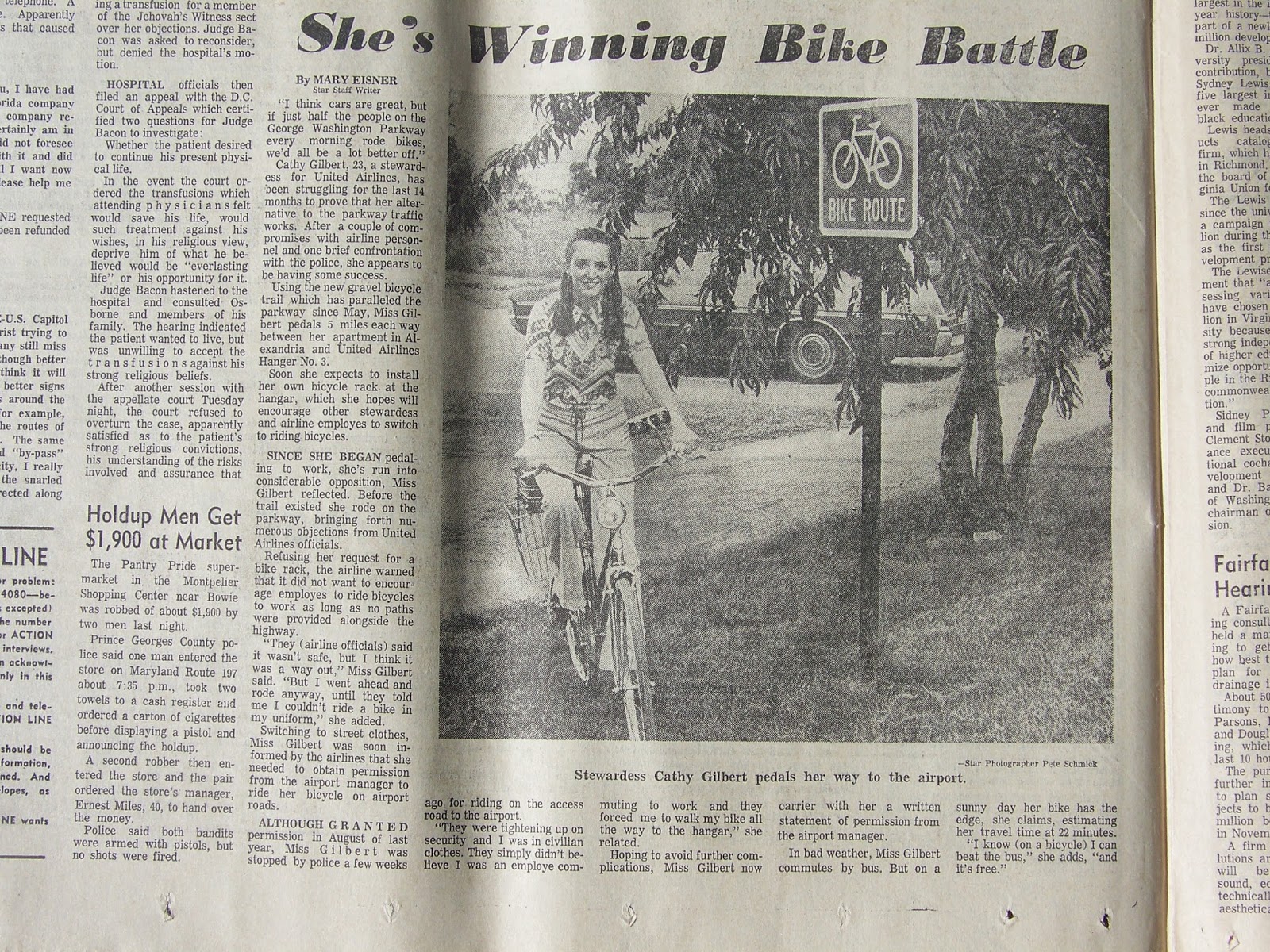
The Mount Vernon Trail (MVT) is a 17 miles (27 km) paved bicycle and pedestrian path in Northern Virginia between Rosslyn and George Washington's home at Mount Vernon. The trail connects the easternmost portions of Arlington County, the City of Alexandria, and Fairfax County, and travels mostly on dedicated trail with a small portion on city streets. As part of U.S. Bike Route 1, the MVT opened in May 1972 as a gravel path and was subsequently expanded and paved.[1]
The MVT is the completed portions of the much larger mid-Atlantic Potomac Heritage National Scenic Trail.
History
The MVT opened in May 1972 as a gravel path that was paved prior to 1980 and expanded in 1988.[2]
Since it opened it has been expanded, widened, improved and connected to as parts of many projects. In 1980, as part of construction of seven bridges across Four Mile Run - Potomac Yard railroad bridges, Route 1 and the George Washington Parkway - the Army Corps of Engineers built an extension of the Four Mile Run Trail beneath them that connected the trail to the Mount Vernon Trail.[3]On December 7, 1988, the Park Service expanded the trail north from Arlington Memorial Bridge to Roosevelt Island where a new bridge over the Parkway, which opened in February 1987, connected it to the Custis Trail.[4][5] Later a new trail segment was built in Fort Hunt Park where the trail had been on road.[6] In March of 1992, work began on the Crystal City Connector Trail that connected the trail to Crystal City via a pedestrian tunnel that had been built when the railway was moved nearly a decade beforehand.[7] The Connector opened on August 22, 1992.[8] In was determined that the bridge over the north entrance to National Airport was deteriorating and that the Mount Vernon Trail was a safety concern because of its close proximity to the roadway. In 2007 the bridge was rebuilt and the trail was realigned and widened in the area.[9] In 2009, the trail on the new Woodrow Wilson Bridge opened with a connection to the Mount Vernon Trail and in 2013, the trail beneath the bridge and approaching it was rebuilt.[10] In 2011, the National Park Service rebuilt the Humpback Bridge, which involved changes to the roadway, widening the Mount Vernon Trail, adding a barrier to separate the trail users from the traffic, lowering the grade across the bridge to improve sight distance, and adding a pair of trail tunnels under the bridge for safer passage between the Columbia Island Marina, the Mount Vernon Trail and, in the future, Boundary Channel Drive.[11] In 2012, the Park Service realigned the trail at Memorial Circle, moving the crossing of Washington Boulevard a few hundred feet south and creating a crossing at a right angle to the road.[12]
In 2002, the National Park Service performed a feasibility study on expanding the Mt Vernon Trail north to the American Legion Bridge. The design proposed was a mostly on-street route, with a pair of trail segments west of Glebe Road.<ref>LDR International (2002). Mount Vernon Multi-Use Trail Extension Feasibility Study (Report). Retrieved 25 September 2018.
Description
The trail parallels the George Washington Memorial Parkway and the western bank of the Potomac River. Most of the northern half of the trail is open with views of the river and of Washington, D.C. The southern 8 miles (13 km) below Alexandria is largely wooded with limited river views.
From its northern trailhead at a parking lot near Theodore Roosevelt Island, the MVT travels south near the Potomac River until it turns inland to pass between the Parkway and the west side of Ronald Reagan Washington National Airport. Before reaching the airport, the trail passes through Gravelly Point, where there are often views of arriving and departing airplane. A connecting trail travels through the airport and provides access to the Ronald Reagan Washington National Airport Metro Station and the Abingdon Plantation historic site.

After passing the airport, the trail crosses Four Mile Run and continues south on city streets into Old Town Alexandria. After crossing under the Woodrow Wilson Bridge and over Hunting Creek, the trail continues south along the Potomac River, traveling near Belle Haven, the west side of Dyke Marsh and the east side of Fort Hunt Park. The last mile before reaching Mount Vernon is a curving uphill inland climb.
Connecting trails
The Mount Vernon Trail connects to other area hiker/biker routes including:
- East Coast Greenway - a 3,000 mile long system of trails connecting Maine to Florida.
- Woodrow Wilson Bridge Trail, which crosses the Potomac River and provides access to National Harbor in Prince George's County, Maryland.
- Four Mile Run Trail, a 7 miles (11 km) paved trail that begins near the boundary between Arlington County and the City of Falls Church and travels east to meet the Mount Vernon Trail south of Ronald Reagan Washington National Airport.
- Washington & Old Dominion Railroad Trail, a 44.8 miles (72.1 km) paved rail trail that travels northwest from the Arlington County/Alexandria boundary to Purcellville, Virginia (accessed from the Four Mile Run Trail).
- Rock Creek Park Trail, a paved trail that travels north through Washington, D.C., and Montgomery County, Maryland and ends near Lake Needwood (accessed from the Arlington Memorial Bridge).
- Chesapeake and Ohio Canal towpath, an unpaved path that travels northwest from Georgetown in Washington, D.C., for 184.4 miles (296.8 km) to Cumberland, Maryland (accessed from the Francis Scott Key Bridge).
- Capital Crescent Trail, a partially paved rail trail that travels east and south for 11 miles (18 km) from Silver Spring, Maryland| through Bethesda, Maryland to Georgetown (accessed from the Francis Scott Key Bridge).
- Custis Trail, a 4 miles (6 km) paved trail that begins in Rosslyn at the end of the Mount Vernon Trail, travels west alongside I-66 and connects to the Washington & Old Dominion Railroad Trail.
- Northern Extension (Potomac Heritage Trail):, a 10 miles (16 km) unpaved hiking trail beginning at the end of the Mount Vernon Trail northwest of Theodore Roosevelt Island and traveling northwest through Arlington and Fairfax Counties in and near the Potomac River gorge and near the George Washington Memorial Parkway. The trail travels near the shoreline of the Potomac River, crosses under the Francis Scott Key Bridge and passes Chain Bridge. The trail then travels inland along Pimmit Run, passes Fort Marcy Park, returns to the Potomac's shoreline and passes Turkey Run Park. The trail ends after passing beneath the American Legion Memorial Bridge, which carries the Capital Beltway (Interstate 495) over the Potomac River.
Gallery
Scenes along the Mount Vernon Trail, from south to north:
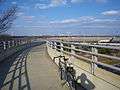
 Beginning of the trail at Mount Vernon
 Boardwalk passing through Dyke Marsh
- Mount Vernon Trail at Belle Haven
 Bridge over airport traffic at Ronald Reagan Washington National Airport
 Watching airplanes take off from Gravelly Point
 Tulips in bloom in front of the Navy-Merchant Marine Memorial
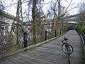 Standing in front of Theodore Roosevelt Bridge
Notes
- ↑ Eisner, Mary (1972). "She's Winning Bike Battle". Washington Star. Washington, DC. Retrieved 2014-07-30.
- ↑ MacNamara, James (12 September 1980). "Pedal Power: Many Paths To Pleasure". The Washington Post.
- ↑ Hodge, Paul (24 January 1980). "Seven Bridges Span Four Mile Run Flood-Control Project and Bicycle Trail". The Washington Post.
- ↑ Brooks, Dudley (12 June 1988). "Bikers' Bridge". The Washington Post.
- ↑ "Opening New Frontiers". The Washington Post. 8 December 1988.
- ↑ Mansfield, Virginia (2 July 1987). "Three Heavily Used Bicycle Trails To Be Linked, Raising Safety Issue". The Washington Post.
|access-date=requires|url=(help) - ↑ Kaplow, Bobby (19 March 1992). "New Path for Bicyclists". The Washington Post.
|access-date=requires|url=(help) - ↑ "Crystal City Trail Connector To Bow Saturday With Pomp". 20 August 1992.
|access-date=requires|url=(help) - ↑ U.S. DEPARTMENT OF THE INTERIOR, et. al. (March 2008). GWMP North Section Rehabilitation Environmental Assessment/Assessment of Effect (Report). National Park Service. p. 72-73. Retrieved 25 September 2018.
- ↑ Lazo, Luz (13 May 2013). "Wilson Bridge trail encourages bike commuting between Pr. George's and Northern Virginia". Retrieved 25 September 2018.
- ↑ "THE ABC CHESAPEAKE PROJECT OF THE YEAR: HUMPBACK BRIDGE REPLACEMENT". Retrieved 25 September 2018.
- ↑ ": New GW ParHighway Path Marked". Retrieved 25 September 2018.
References
- "Mount Vernon Trail". George Washington Memorial Parkway. National Park Service. Archived from the original on 2012-11-09. Retrieved 2015-06-23. External link in
|work=(help) - "Mount Vernon Trail". George Washington Memorial Parkway. National Park Service. Archived from the original on 2015-04-15. Retrieved 2015-06-23. External link in
|work=(help) - "The Mount Vernon Trail". Washington DC Multi-Use Trails. Bike Washington.org. Retrieved 2012-01-02. External link in
|publisher=, |work=(help) - "Mount Vernon Trail, Virginia". Virginia Bike Trails: TrailLink.com. Rails-to-Trails Conservancy. Retrieved 2012-01-02. External link in
|work=(help) - Cooper, Rachel. "Mount Vernon Trail – Northern Virginia's Scenic Trail". About.com: Washington, D.C. About.com. Retrieved 2012-01-02. External link in
|work=(help) - "Potomac Heritage Trail - Chain Bridge Section". Trail Voice. Retrieved 2012-01-02. External link in
|publisher=(help)
External links
| Wikimedia Commons has media related to Mount Vernon Trail. |
Coordinates: 38°42′36″N 77°03′41″W / 38.710008°N 77.061351°W
| ||