Mount Sikaram
| Mount Sikaram | |
|---|---|
|
سیکارام | |
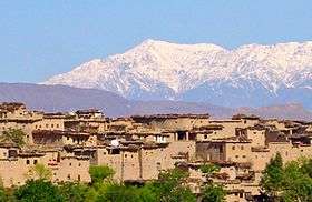 Mount Sikaram viewed from the Kurram Valley | |
| Highest point | |
| Elevation | 4,755 m (15,600 ft) [1] |
| Prominence | 2,295 m (7,530 ft) [1] |
| Listing | Ultra |
| Coordinates | 34°02′18″N 69°54′09″E / 34.03833°N 69.90250°ECoordinates: 34°02′18″N 69°54′09″E / 34.03833°N 69.90250°E [1] |
| Geography | |
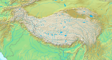 Mount Sikaram Location in the Western Himalayas on Afghanistan–Pakistan border | |
| Location | Afghanistan - Pakistan Border |
| Countries | Afghanistan and Pakistan |
| Province | Border triangle of Logar, Paktia and Parachinar |
| Parent range |
Spin Ghar, Hindu Kush, Western Himalayas |
Mount Sikaram is a mountain on the Afghanistan–Pakistan border, south of the Kabul River and Khyber Pass. At 4,755 metres (15,600 ft),[1] it is the highest peak of the Spīn Ghar mountain range, also known as Safēd Kōh.[2]
Location
Mount Sikaram is located north of the village Peiwar in Kurram Agency. It's parent range, Spīn Ghar, connects directly with the Shandūr offshoot of the Hindu Kush mountain system which is interrupted by the Kābul River, the river cuts a narrow gorge through the mountains and flows eastward into the Indus River. Atop the range, temperatures can fall below 0°C at any time of the year.[3]
A small valley on the slope of Mount Sikaram encompasses a number of villages, districts and tribal regions including Peiwar, Alizai, Tari Mangal, Narai, Speena Shaga and Khewas, many of which are historically significant. The Gawi Pass, also known as the Peiwar Kotal Pass, runs between the Kurram Valley and Afghanistan's Aryub Valley, connecting the Paktia Province of Afghanistan with the Kurram Agency in the Federally Administered Tribal Areas of Pakistan.
History
1878 - British forces serving under Sir Frederick Roberts outmanoeuvred Afghan forces and secured a British victory and control of the Peiwar Pass in the Battle of Peiwar Kotal.
1878-1879 - British surveyor George Batley Scott climbed the mountain during a campaign to survey Afghanistan.[4]
Also look at
References
- 1 2 3 4 "Afghanistan and Central/Southern Pakistan". Peaklist.org. Retrieved 2014-05-27.
- ↑ "Safīd Mountain Range on Pakistan-Afghanistan Border". Earth Snapshot. 2010-03-12. Retrieved 2018-06-27.
- ↑ "South Afghanistan, Afghanistan Mount Sikaram". Triposo Travel Guide. Retrieved 21 July 2018.
- ↑ Boleslaw Chwaściński: The Exploration of the Hindu Kush. In: The Alpine Journal. Bd. 71, Nr. 2 = Nr. 313, 1966, S. 199–214, hier S. 203, (PDF; 6.5 MB).