Mount Liebig
| Mount Liebig | |
|---|---|
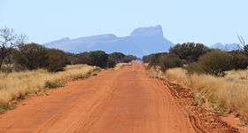 Viewed from the Gary Junction Road looking east. | |
| Highest point | |
| Elevation | 1,274 m (4,180 ft) AHD |
| Coordinates | 23°18′S 131°22′E / 23.300°S 131.367°ECoordinates: 23°18′S 131°22′E / 23.300°S 131.367°E |
| Naming | |
| Etymology | Justus von Liebig |
| Geography | |
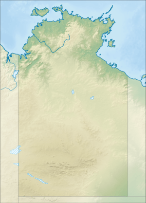 Mount Liebig Location in the Northern Territory | |
| Location | Northern Territory, Australia |
| Parent range | MacDonnell Ranges |
Mount Liebig is a mountain with an elevation of 1,274 metres (4,180 ft) AHD in the southern part of the Northern Territory of Australia. It is one of the highest peaks of the MacDonnell Ranges and was named by the explorer Ernest Giles after the German chemist Justus von Liebig.[1] Nearby settlements include Haasts Bluff.
Notable Indigenous Australians who have lived in the region of Mount Liebig include Indigenous artist Nora Andy Napaltjarri[2] and Ngoia Pollard Napaltjarri.[3]
See also
References
- ↑ Ernest Favenc: The History of Australian Exploration from 1788 to 1888. Echo Library 2006, ISBN 978-1-4068-2067-6, p. 184
- ↑ Johnson, Vivien (1994). Aboriginal Artists of the Western Desert: A Biographical Dictionary. Roseville East, NSW: Craftsman House. pp. 60–61.
- ↑ McCulloch Childs, Emily; Gibson, Ross (2008). New Beginnings: Classic Paintings from the Corrigan Collection of 21st Century Aboriginal Art. Fitzroy, VIC: McCulloch & McCulloch Australian Art Books. p. 106. ISBN 978-0-9804494-4-0.
External links
- Mt. Liebig at www.peakbagger.com; (retrieved 2009-9-3)
- Mount Liebig and Surrounds (pdf) - brochure by the government of the Northern Territory (retrieved 2009-9-3)
This article is issued from
Wikipedia.
The text is licensed under Creative Commons - Attribution - Sharealike.
Additional terms may apply for the media files.