Mount Kubor
| Mount Kubor | |
|---|---|
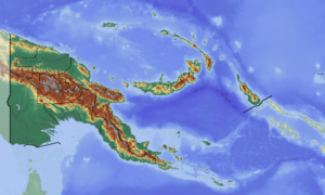 Mount Kubor Location in Papua New Guinea | |
| Highest point | |
| Elevation | 4,359 m (14,301 ft) [1] |
| Coordinates | 6°06′S 144°45′E / 6.100°S 144.750°ECoordinates: 6°06′S 144°45′E / 6.100°S 144.750°E [1] |
| Geography | |
| Location | Simbu Province, Papua New Guinea |
Mount Kubor (also known as Mount Leahy [2] in honor of Mick Leahy (explorer) ) is a peak in the Kubor Range in the New Guinea Highlands, in the Simbu Province of Papua New Guinea. [1]
History
Mount Kubor was named in 1933 by a member of the first Western expedition group to survey the area.[3]
References
- 1 2 3 Mount Kubor, Papua New Guinea Peakbagger.com
- ↑ Mount Leahy (Mount Kubor) / Papua New Guine at http://www.getamap.net/
- ↑ Spinks, K. L. (1936). "The Wahgi River Valley of Central New Guinea". The Geographical Journal. 87 (3): 225. doi:10.2307/1786762. ISSN 0016-7398. JSTOR 1786762.
Mr. J. L. Taylor, a member of the exploration party, exercised his privilege as an Administration Officer to give European names to them. It is the writer's opinion that they should bear the euphonious names by which they are known to the natives of the Wahgi River valley. Moreover these names allow of immediate identification by reference to the natives themselves.
Highest Mountains of Papua New Guinea | ||
|---|---|---|
| ||
This article is issued from
Wikipedia.
The text is licensed under Creative Commons - Attribution - Sharealike.
Additional terms may apply for the media files.