Mount Hochlin
Mount Hochlin
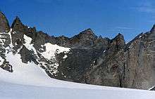
Mount Hochlin (72°5′S 4°3′E / 72.083°S 4.050°ECoordinates: 72°5′S 4°3′E / 72.083°S 4.050°E) is a large ice-topped mountain, 2,760 metres (9,060 ft) high, standing east of Festninga Mountain in the Mühlig-Hofmann Mountains of Queen Maud Land, Antarctica. It was mapped by Norwegian cartographers from surveys and air photos by the Sixth Norwegian Antarctic Expedition (1956–60) and named for L. Hochlin, a radio operator and dog driver with the expedition (1956–58).[1]
References
- ↑ "Hochlin, Mount". Geographic Names Information System. United States Geological Survey. Retrieved 2012-06-20.
![]()
This article is issued from
Wikipedia.
The text is licensed under Creative Commons - Attribution - Sharealike.
Additional terms may apply for the media files.