Mount Guntur
| Mount Guntur | |
|---|---|
 | |
| Highest point | |
| Elevation | 2,249 m (7,379 ft) |
| Listing | Ribu |
| Coordinates | 7°08′35″S 107°50′24″E / 7.143°S 107.840°ECoordinates: 7°08′35″S 107°50′24″E / 7.143°S 107.840°E |
| Geography | |
| Geology | |
| Mountain type | Stratovolcano |
| Volcanic arc/belt | Pacific Ring of Fire |
| Last eruption | October 1847 |
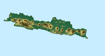
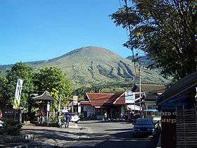
Mount Guntur or Gunung Guntur is an active stratovolcano in western Java. It is part of a complex of several overlapping stratovolcanoes about 10 km (6.2 mi) northwest of the city of Garut. The last eruption was in 1847. At an elevation of 2,249 m (7,379 ft), Mount Guntur rises about 1,500 m (4,900 ft) above the plain of Garut. It produced frequent explosive eruptions in the 19th century, making it one of the most active volcanoes of western Java. Since then it has not erupted. The name Guntur means "thunder" in the Indonesian language.
The Kamojang crater, a geothermal power field and a tourist site, is located on the slopes of Mount Guntur.
See also
References
This article is issued from
Wikipedia.
The text is licensed under Creative Commons - Attribution - Sharealike.
Additional terms may apply for the media files.