Mount Giles
- See also Mount Giles (Antarctica)
| Mount Giles | |
|---|---|
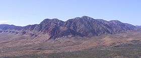 Mount Giles from the opposite side of Ormiston Pound in the south | |
| Highest point | |
| Elevation | 1,389 m (4,557 ft) AHD |
| Coordinates | 23°37′44″S 132°51′42″E / 23.628798°S 132.861614°ECoordinates: 23°37′44″S 132°51′42″E / 23.628798°S 132.861614°E |
| Geography | |
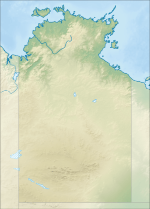 Mount Giles Location in the Northern Territory | |
| Location | Northern Territory, Australia |
| Parent range | MacDonnell Ranges |
| Climbing | |
| Easiest route | Larapinta Trail |
Mount Giles is one of the highest mountains in the Northern Territory, Australia, at 1,389 metres (4,557 ft) AHD . It lies along the MacDonnell Ranges, dominating Ormiston Pound, in the West MacDonnell National Park, approximately 80 kilometres (50 mi) west of Alice Springs. It can be visited via the celebrated Larapinta Trail and has views of Mount Sonder, Ormiston Gorge and Pound, and the surrounding range.
Climbing the mountain requires a hard two- or three-day hike.[1]
See also
References
- ↑ Stanton, Jenny (2000). The Australian Geographic Book of the Red Centre. Terrey Hills, New South Wales: Australian Geographic. p. 100. ISBN 1-86276-013-6.
External links
This article is issued from
Wikipedia.
The text is licensed under Creative Commons - Attribution - Sharealike.
Additional terms may apply for the media files.