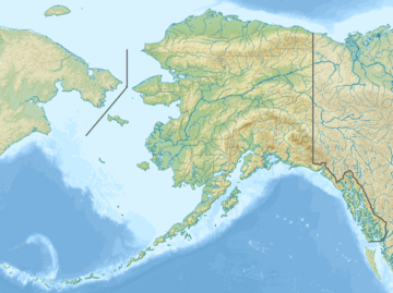
Mount Armour
| Mount Armour | |
|---|---|
| Boundary Peak 175 | |
| Highest point | |
| Elevation | 8,773 ft (2,674 m) |
| Prominence | 2,310 ft (700 m) |
| Coordinates | 59°54′23″N 138°43′04″W / 59.90639°N 138.71778°WCoordinates: 59°54′23″N 138°43′04″W / 59.90639°N 138.71778°W |
| Geography | |
| Location |
Stikine Region, British Columbia Glacier Bay National Park and Preserve, Alaska |
Mount Armour, also named Boundary Peak 175, is a mountain in Alaska and British Columbia, located on the Canada–United States border, and part of the Southern Icefield Ranges of the Saint Elias Mountains.[1] It is named after John Douglas Armour (1830–1903), Chief Justice of the High Court of Ontario, and Justice of the Supreme Court of Canada, one of the original Canadian members of the Alaskan Boundary Tribunal in 1903 and who was involved in settling the Alaska boundary dispute between the United States and Canada.[2]
See also
References
This article is issued from
Wikipedia.
The text is licensed under Creative Commons - Attribution - Sharealike.
Additional terms may apply for the media files.
