Moult, Calvados
| Moult | |
|---|---|
 | |
 Moult Location within Normandy region  Moult | |
| Coordinates: 49°06′58″N 0°09′50″W / 49.1161°N 0.1639°WCoordinates: 49°06′58″N 0°09′50″W / 49.1161°N 0.1639°W | |
| Country | France |
| Region | Normandy |
| Department | Calvados |
| Arrondissement | Caen |
| Canton | Troarn |
| Area1 | 10.26 km2 (3.96 sq mi) |
| Population (2008)2 | 1,742 |
| • Density | 170/km2 (440/sq mi) |
| Time zone | UTC+1 (CET) |
| • Summer (DST) | UTC+2 (CEST) |
| INSEE/Postal code | 14456 /14370 |
| Elevation |
19–76 m (62–249 ft) (avg. 60 m or 200 ft) |
|
1 French Land Register data, which excludes lakes, ponds, glaciers > 1 km2 (0.386 sq mi or 247 acres) and river estuaries. 2 Population without double counting: residents of multiple communes (e.g., students and military personnel) only counted once. | |
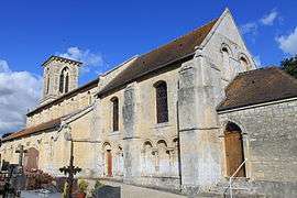
Moult (French pronunciation: [mul]) is a former commune in the Calvados department in the Normandy region in northwestern France. On 1 January 2017, it was merged into the new commune Moult-Chicheboville.[1] The commune is situated about 16 kilometers from Caen on French Highway 13. It is in the valley of the Muance.
History
The ancient ruins in and around the commune suggest that it was used as a fortified camp that controlled the area between Vieux and Lisieux.
Population
| Historical population | ||
|---|---|---|
| Year | Pop. | ±% |
| 1962 | 675 | — |
| 1968 | 670 | −0.7% |
| 1975 | 765 | +14.2% |
| 1982 | 827 | +8.1% |
| 1990 | 919 | +11.1% |
| 1999 | 1,130 | +23.0% |
| 2008 | 1,742 | +54.2% |
See also
References
- ↑ Arrêté préfectoral 8 September 2016 (in French)
External links
| Wikimedia Commons has media related to Moult (Calvados). |
This article is issued from
Wikipedia.
The text is licensed under Creative Commons - Attribution - Sharealike.
Additional terms may apply for the media files.