Mormaison
| Mormaison | |
|---|---|
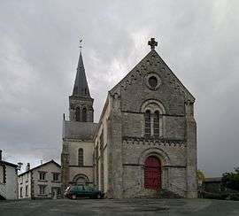 The church of Our Lady of the Assumption, in Mormaison | |
 Mormaison Location within Pays de la Loire region  Mormaison | |
| Coordinates: 46°54′28″N 1°26′56″W / 46.9078°N 1.4489°WCoordinates: 46°54′28″N 1°26′56″W / 46.9078°N 1.4489°W | |
| Country | France |
| Region | Pays de la Loire |
| Department | Vendée |
| Arrondissement | La Roche-sur-Yon |
| Canton | Aizenay |
| Intercommunality | Canton de Rocheservière |
| Government | |
| • Mayor (2008–2014) | Hubert Delhommeau |
| Area1 | 15.44 km2 (5.96 sq mi) |
| Population (2006)2 | 1,002 |
| • Density | 65/km2 (170/sq mi) |
| Time zone | UTC+1 (CET) |
| • Summer (DST) | UTC+2 (CEST) |
| INSEE/Postal code | 85150 /85260 |
| Elevation | 27–71 m (89–233 ft) |
|
1 French Land Register data, which excludes lakes, ponds, glaciers > 1 km2 (0.386 sq mi or 247 acres) and river estuaries. 2 Population without double counting: residents of multiple communes (e.g., students and military personnel) only counted once. | |
Mormaison is a former commune in the Vendée department in the Pays de la Loire region in western France. On 1 January 2016, it was merged into the new commune of Montréverd.[1]
See also
References
- ↑ Arrêté préfectoral 15 December 2015
| Wikimedia Commons has media related to Mormaison. |
This article is issued from
Wikipedia.
The text is licensed under Creative Commons - Attribution - Sharealike.
Additional terms may apply for the media files.