Morel (les Saintes)
| Morel | |
|---|---|
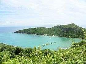 Morel hill view from Fort Napoléon | |
| Highest point | |
| Elevation | 446 ft (136 m) |
| Coordinates | 15°52′33″N 61°34′27″W / 15.87583°N 61.57417°WCoordinates: 15°52′33″N 61°34′27″W / 15.87583°N 61.57417°W |
| Geography | |
 Morel | |
| Geology | |
| Mountain type | Basalt |
| Volcanic arc/belt | Lesser Antilles Volcanic Arc |
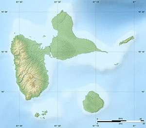
Morel is a mountain located on Terre-de-Haut Island on the archipelago of Îles des Saintes, in the Lesser Antilles with the height of 136 meters (446 feet).
Situated in the North of the island, between the bay of Marigot and the bay of Pompierre, it is one of the principal height of the archipelago. It shelters an ancient fortress, called Caroline battery.[1][2]
See also
References
- ↑ Popo (18 May 2010). "Morne Morel à Terre de Haut". Zoom-guadeloupe.fr. Retrieved December 2012. Check date values in:
|accessdate=(help) - ↑ "Monographie sur les Saintes (dépendance de la Guadeloupe)" (in French). Gallica.bnf.fr. 25 January 2010. Retrieved December 2012. Check date values in:
|accessdate=(help)
This article is issued from
Wikipedia.
The text is licensed under Creative Commons - Attribution - Sharealike.
Additional terms may apply for the media files.