Montura, Florida
| Montura, Florida | |
|---|---|
| Census-designated place | |
 Montura  Montura | |
| Coordinates: 26°38′34″N 81°05′38″W / 26.64278°N 81.09389°WCoordinates: 26°38′34″N 81°05′38″W / 26.64278°N 81.09389°W | |
| Country | United States |
| State | Florida |
| County | Hendry |
| Area[1] | |
| • Total | 22.379 sq mi (57.96 km2) |
| • Land | 22.379 sq mi (57.96 km2) |
| • Water | 0 sq mi (0 km2) |
| Elevation | 26 ft (8 m) |
| Population (2010)[1] | |
| • Total | 3,283 |
| • Density | 150/sq mi (57/km2) |
| Time zone | UTC-5 (Eastern (EST)) |
| • Summer (DST) | UTC-4 (EDT) |
| Area code(s) | 863 |
| GNIS feature ID | 2583364[2] |
Montura is an unincorporated community and census-designated place in Hendry County, Florida, United States. Its population was 3,283 as of the 2010 census.[1]
Geography
According to the U.S. Census Bureau, the community has an area of 22.379 square miles (57.96 km2), all of it land.[1]
References
Municipalities and communities of Hendry County, Florida, United States | ||
|---|---|---|
| Cities | 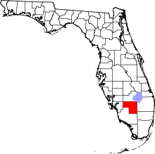 | |
| CDPs | ||
| Indian reservation | ||
| Unincorporated community | ||
| Footnotes | ‡This populated place also has portions in an adjacent county or counties | |
This article is issued from
Wikipedia.
The text is licensed under Creative Commons - Attribution - Sharealike.
Additional terms may apply for the media files.