Montevideo, Minnesota
| Montevideo, Minnesota | |
|---|---|
| City | |
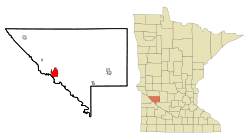 Location of Montevideo within Chippewa County, Minnesota | |
| Coordinates: 44°56′55″N 95°43′13″W / 44.94861°N 95.72028°W | |
| Country | United States |
| State | Minnesota |
| County | Chippewa |
| Government | |
| • Type | Council – Manager |
| Area[1] | |
| • Total | 4.85 sq mi (12.56 km2) |
| • Land | 4.76 sq mi (12.33 km2) |
| • Water | 0.09 sq mi (0.23 km2) |
| Elevation | 932 ft (284 m) |
| Population (2010)[2] | |
| • Total | 5,383 |
| • Estimate (2016)[3] | 5,207 |
| • Density | 1,100/sq mi (430/km2) |
| Time zone | UTC-6 (Central (CST)) |
| • Summer (DST) | UTC-5 (CDT) |
| ZIP code | 56265 |
| Area code(s) | 320 |
| FIPS code | 27-43720[4] |
| GNIS feature ID | 0648046[5] |
| Website | www.montevideomn.org |
Montevideo /ˌmɒntəˈvɪdi.oʊ/ is a city in Chippewa County, Minnesota, United States. The population was 5,383 at the 2010 census.[6] It is the county seat of Chippewa County. The town's current mayor is Debra Lee Fader.
Geography
Montevideo is located in a double river valley where the Minnesota and Chippewa rivers converge, approximately 140 miles (230 km) west of Minneapolis, at the junction of U.S. Highways 59 and 212 with Minnesota State Highways 7 and 29.
The surrounding topography is dominated by farmland and prairies, as well as river valleys with many scenic overlooks and small bluffs.
According to the United States Census Bureau, the city has a total area of 4.85 square miles (12.56 km2), of which, 4.76 square miles (12.33 km2) is land and 0.09 square miles (0.23 km2) is water.[1]
Climate
Montevideo, as with the rest of Minnesota, has a four-season humid continental climate with great differences between summer and winter.[7] The average July high is 28 °C (82 °F) with the average January high being −6 °C (21 °F).[8]
| Climate data for Montevideo, Minnesota | |||||||||||||
|---|---|---|---|---|---|---|---|---|---|---|---|---|---|
| Month | Jan | Feb | Mar | Apr | May | Jun | Jul | Aug | Sep | Oct | Nov | Dec | Year |
| Record high °F (°C) | 68 (20) |
61 (16) |
79 (26) |
90 (32) |
104 (40) |
102 (39) |
106 (41) |
100 (38) |
104 (40) |
91 (33) |
73 (23) |
63 (17) |
106 (41) |
| Average high °F (°C) | 21 (−6) |
25 (−4) |
36 (2) |
54 (12) |
68 (20) |
77 (25) |
82 (28) |
81 (27) |
72 (22) |
59 (15) |
37 (3) |
27 (−3) |
53 (12) |
| Daily mean °F (°C) | 12 (−11) |
16 (−9) |
28 (−2) |
43 (6) |
55 (13) |
64 (18) |
70 (21) |
68 (20) |
59 (15) |
46 (8) |
30 (−1) |
19 (−7) |
43 (6) |
| Average low °F (°C) | 3 (−16) |
5 (−15) |
19 (−7) |
34 (1) |
45 (7) |
54 (12) |
59 (15) |
57 (14) |
48 (9) |
36 (2) |
21 (−6) |
10 (−12) |
33 (0) |
| Record low °F (°C) | −36 (−38) |
−36 (−38) |
−31 (−35) |
−4 (−20) |
21 (−6) |
32 (0) |
37 (3) |
32 (0) |
21 (−6) |
0 (−18) |
−22 (−30) |
−35 (−37) |
−36 (−38) |
| Average precipitation inches (mm) | 0.39 (10) |
0.39 (10) |
1.18 (30) |
1.97 (50) |
2.76 (70) |
3.94 (100) |
2.76 (70) |
3.54 (90) |
2.76 (70) |
1.18 (30) |
0.79 (20) |
0.39 (10) |
22.05 (560) |
| Source: [9] | |||||||||||||
Demographics
| Historical population | |||
|---|---|---|---|
| Census | Pop. | %± | |
| 1880 | 862 | — | |
| 1890 | 1,437 | 66.7% | |
| 1900 | 2,146 | 49.3% | |
| 1910 | 3,056 | 42.4% | |
| 1920 | 4,419 | 44.6% | |
| 1930 | 4,319 | −2.3% | |
| 1940 | 5,220 | 20.9% | |
| 1950 | 5,459 | 4.6% | |
| 1960 | 5,693 | 4.3% | |
| 1970 | 5,661 | −0.6% | |
| 1980 | 5,845 | 3.3% | |
| 1990 | 5,499 | −5.9% | |
| 2000 | 5,346 | −2.8% | |
| 2010 | 5,383 | 0.7% | |
| Est. 2016 | 5,207 | [3] | −3.3% |
| U.S. Decennial Census | |||
2010 census
As of the census[2] of 2010, there were 5,383 people, 2,326 households, and 1,404 families residing in the city. The population density was 1,130.9 inhabitants per square mile (436.6/km2). There were 2,510 housing units at an average density of 527.3 per square mile (203.6/km2). The racial makeup of the city was 92.0% White, 0.6% African American, 0.7% Native American, 0.5% Asian, 4.6% from other races, and 1.5% from two or more races. Hispanic or Latino of any race were 8.4% of the population.
There were 2,326 households of which 28.0% had children under the age of 18 living with them, 44.5% were married couples living together, 11.1% had a female householder with no husband present, 4.8% had a male householder with no wife present, and 39.6% were non-families. 35.1% of all households were made up of individuals and 18.2% had someone living alone who was 65 years of age or older. The average household size was 2.25 and the average family size was 2.86.
The median age in the city was 41 years. 23.4% of residents were under the age of 18; 8% were between the ages of 18 and 24; 23.1% were from 25 to 44; 25% were from 45 to 64; and 20.3% were 65 years of age or older. The gender makeup of the city was 47.0% male and 53.0% female.
2000 census
As of the census[4] of 2000, there were 5,346 people, 2,353 households, and 1,444 families residing in the city. The population density was 1,190.5 people per square mile (459.7/km²). There were 2,551 housing units at an average density of 568.1 per square mile (219.4/km²). The racial makeup of the city was 97.10% White, 0.11% African American, 0.41% Native American, 0.34% Asian, 0.06% Pacific Islander, 0.80% from other races, and 1.18% from two or more races. Hispanic or Latino of any race were 2.00% of the population.
There were 2,353 households out of which 28.6% had children under the age of 18 living with them, 48.6% were married couples living together, 9.2% had a female householder with no husband present, and 38.6% were non-families. 34.8% of all households were made up of individuals and 18.3% had someone living alone who was 65 years of age or older. The average household size was 2.24 and the average family size was 2.89.
In the city, the population was spread out with 24.5% under the age of 18, 8.0% from 18 to 24, 24.3% from 25 to 44, 22.6% from 45 to 64, and 20.6% who were 65 years of age or older. The median age was 40 years. For every 100 females, there were 89.2 males. For every 100 females age 18 and over, there were 86.3 males.
The median income for a household in the city was $32,447, and the median income for a family was $44,706. Males had a median income of $30,838 versus $19,013 for females. The per capita income for the city was $18,025. About 4.7% of families and 10.1% of the population were below the poverty line, including 12.2% of those under age 18 and 8.9% of those age 65 or over.
In popular culture
- Montevideo was featured in the 2005 film Sweet Land as the town Audubon, Minnesota in the 1920s.
- Montevideo was a grand finalist in the Real World Road Rules Challenge 2000.
Sister Cities
Montevideo is a sister city of:
Local Media
KDMA, KKRC, and KMGM are local radio stations owned by Iowa City Broadcasting Company, Inc. KRAM-LP is owned by Thunderhawk Broadcasting, Inc.
Notable people
- Paul Gruchow (1947–2004), Former professor at St. Olaf and Concordia colleges, and former editor of the Worthington Daily Globe in Worthington. Essayist whose publications include Grass Roots: The Universe of Home (Milkweed Editions, 1995) and Boundary Waters: The Grace of the Wild. Prior to his suicide, he was a contributing writer to several periodicals including the New York Times and the Hungry Mind Review.
- David Minge (1942–), Former 2nd District congressman (1993–2001) and current judge on the Minnesota Court of Appeals.
- Wayne Brabender (1945–), American-Spaniard professional basketball player for Real Madrid and the Spaniard National Basketball Team.
References
- 1 2 "US Gazetteer files 2010". United States Census Bureau. Archived from the original on 2012-07-14. Retrieved 2012-11-13.
- 1 2 "American FactFinder". United States Census Bureau. Retrieved 2012-11-13.
- 1 2 "Population and Housing Unit Estimates". Retrieved June 9, 2017.
- 1 2 "American FactFinder". United States Census Bureau. Retrieved 2008-01-31.
- ↑ "US Board on Geographic Names". United States Geological Survey. 2007-10-25. Retrieved 2008-01-31.
- ↑ "2010 Census Redistricting Data (Public Law 94-171) Summary File". American FactFinder. United States Census Bureau. Retrieved 27 April 2011.
- ↑ http://www.weatherbase.com/weather/weather-summary.php3?s=17037&cityname=Montevideo%2C+Minnesota%2C+United+States+of+America&units=
- ↑ http://www.weatherbase.com/weather/weather.php3?s=17037&cityname=Montevideo-Minnesota-United-States-of-America
- ↑ "Montevideo, Minnesota". Retrieved 14 November 2014.
External links
| Wikimedia Commons has media related to Montevideo, Minnesota. |
| Wikisource has the text of a 1905 New International Encyclopedia article about Montevideo, Minnesota. |
- City of Montevideo, MN – Official Website
- Montevideo, MN Chamber of Commerce
- Montevideo Public Schools
- Montevideo American-News site
- Milwaukee Road Heritage Center site
- Montevideo Industrial Development Corporation
- "Verdi Gilbertson History
- Montevideo, Minnesota Police Department
Municipalities and communities of Chippewa County, Minnesota, United States | ||
|---|---|---|
| Cities | 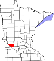 | |
| Townships | ||
| Unincorporated communities | ||
| Footnotes | ‡This populated place also has portions in an adjacent county or counties | |
Coordinates: 44°56′33″N 95°43′25″W / 44.94250°N 95.72361°W