Monterey Park, Calgary
| Monterey Park | |
|---|---|
| Neighbourhood | |
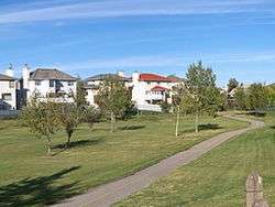 Monterey Park residential homes | |
 Monterey Park Location of Monterey Park in Calgary | |
| Coordinates: 51°04′54″N 113°55′44″W / 51.08167°N 113.92889°WCoordinates: 51°04′54″N 113°55′44″W / 51.08167°N 113.92889°W | |
| Country |
|
| Province |
|
| City |
|
| Quadrant | NE |
| Ward | 5 |
| Established | 1985 |
| Annexed | 1979 |
| Government[1] | |
| • Mayor | Naheed Nenshi |
| • Administrative body | Calgary City Council |
| • Councillor | Harnirjodh Singh Chahal |
| Area | |
| • Total | 2.7 km2 (1.0 sq mi) |
| Elevation | 1,075 m (3,527 ft) |
| Population (2006)[2] | |
| • Total | 10,599 |
| • Average Income | $64,208 |
| Website | Monterey Park Community Association |
Monterey Park is a residential neighbourhood in the north-east quadrant of Calgary, Alberta. It is located at the eastern edge of the city, and is bounded by McKnight Boulevard to the north, 68 Street E to the west, Trans-Canada Highway to the south and 84 Street E (city limits) to the east.
The land was annexed to the city of Calgary between 1979 and 1983, and Monterey Park was established in 1985. It was named for the city of Monterey Park, California, and the neighbourhood has a California theme (such as street names and building styles). It is represented in the Calgary City Council by the Ward 5 councillor.
The postal code in this area is T1Y.
Demographics
In the City of Calgary's 2012 municipal census, Monterey Park had a population of 10,470 living in 3,164 dwellings, a 0.1% increase from its 2011 population of 10,460.[3] With a land area of 3.4 km2 (1.3 sq mi), it had a population density of 3,080/km2 (7,980/sq mi) in 2012.[3][4]
Residents in this community had a median household income of $64,208 in 2000, and there were 9.9% low income residents living in the neighbourhood.[5] As of 2000, 45.1% of the residents were immigrants. Most buildings were single-family detached homes, and 6.3% of the housing was used for renting.[2]
Education
This neighbourhood has one public elementary school: Monterey Park Elementary School. (K-6)
See also
References
- ↑ "Calgary Elections". City of Calgary. 2017. Retrieved November 12, 2017.
- 1 2 City of Calgary (2006). "Monterey Park Community Statistics" (PDF). Retrieved 2007-05-17.
- 1 2 "2012 Civic Census Results" (PDF). City of Calgary. 2012. Retrieved February 4, 2013.
- ↑ "Community Boundaries" (Esri shapefile). City of Calgary. Retrieved February 5, 2013.
- ↑ City of Calgary (2004). "Ward 5 Profile" (PDF). Archived from the original (PDF) on 2007-08-09. Retrieved 2007-05-16.
External links
Places adjacent to Monterey Park, Calgary | |
|---|---|