Monte San Lorenzo
| San Lorenzo | |
|---|---|
| Monte Cochrane | |
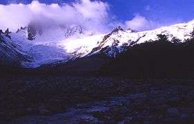 San Lorenzo showing the route of ascent from the Chilean side. | |
| Highest point | |
| Elevation | 3,706 m (12,159 ft) [1] |
| Prominence |
3,319 m (10,889 ft) [2] Ranked 60th |
| Isolation | 135 kilometres (84 mi) |
| Listing | Ultra |
| Coordinates | 47°35′30″S 72°18′24″W / 47.59167°S 72.30667°WCoordinates: 47°35′30″S 72°18′24″W / 47.59167°S 72.30667°W [2] |
| Geography | |
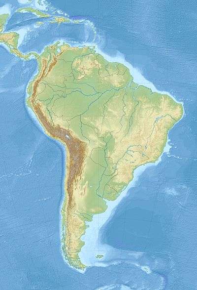 San Lorenzo Location of Monte San Lorenzo | |
| Location |
Patagonia Santa Cruz, Argentina/ Aisén, Chile border |
| Parent range | Andes |
| Climbing | |
| First ascent | 1943 by Alberto María de Agostini[3] |
Monte San Lorenzo, also known as Monte Cochrane, is a mountain on the border between Argentina and Chile in Patagonia, reaching a height of 3,706 metres (12,159 ft).[4] The Chilean name of Cochrane comes from the nearby town of Cochrane where climbers often approach the mountain. The peak was first climbed by Alberto María de Agostini in 1943.
The mountain is covered by three large glaciers (two in Argentina and one in Chile). The Argentine glaciers show clear evidence of retreat.[5]
Incident
The peak gained further notoriety in 2014 when professional ski-mountaineers JP Auclair and Andreas Fransson perished on its slopes in a large avalanche.
Gallery
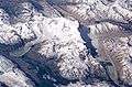 NASA image of San Lorenzo as seen from the south
See also
References
- ↑ "Monte San Lorenzo, Argentina/Chile" Peakbagger.com. Retrieved 2011-11-20.
- 1 2 "Argentina and Chile, Southern - Patagonia Ultra Prominences" Peaklist.org. Retrieved 2011-11-20.
- ↑ Peter Barry, "San Lorenzo", American Alpine Journal, 1973, p. 475. Available at AAJ Online (PDF).
- ↑ World Wildlife Fund; C.Michael Hogan. 2010. Magellanic subpolar forests. Encyclopedia of Earth, National Council for Science and the Environment. Washington DC
- ↑ USGS. "P 1386-I Chile and Argentina - Wet Andes: Northern Patagonian Andes". Retrieved 2006-11-04.
This article is issued from
Wikipedia.
The text is licensed under Creative Commons - Attribution - Sharealike.
Additional terms may apply for the media files.