Monte Freidour
| Monte Freidour | |
|---|---|
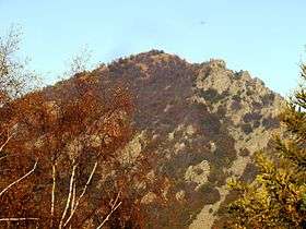 Southern side. | |
| Highest point | |
| Elevation | 1,445 m (4,741 ft) |
| Coordinates | 44°58′22.85″N 7°18′13.49″E / 44.9730139°N 7.3037472°ECoordinates: 44°58′22.85″N 7°18′13.49″E / 44.9730139°N 7.3037472°E |
| Geography | |
 Monte Freidour Location in Italy | |
| Location | Piedmont, Italy |
| Parent range | Cottian Alps |
Monte Freidour is peak in the Cottian Alps, Metropolitan City of Turin in Piedmont, north-western Italy. It has an elevation of 1,445 metres (4,741 ft) and is composed of gneiss cliffs overlooking the town of Cumiana.
At the top of the mount is a monument celebrating the 8 members of the crew (F/Sgt. C.W. Lawton (Australian), Sgt.s T.D. Fotheringham, E.H.A. Clift, G. Tennison, D.W. Bishop, D.R. Wellon, S.E. Lockton and J. Bucks) of a British Liberator bomber that crashed here on 14 October 1944, during a mission in support of Italian partisans. The peak can also be reached from Talucco, a frazione of Pinerolo, and from Cantalupa or Giaveno. The Monte Tre Denti is located nearby.
This article is issued from
Wikipedia.
The text is licensed under Creative Commons - Attribution - Sharealike.
Additional terms may apply for the media files.