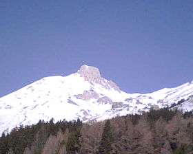
Monte Camicia
| Monte Camicia | |
|---|---|
 | |
| Highest point | |
| Elevation | 2,564 m (8,412 ft) |
| Coordinates | 42°26′N 13°43′E / 42.433°N 13.717°ECoordinates: 42°26′N 13°43′E / 42.433°N 13.717°E |
| Geography | |
 Monte Camicia Italy | |
| Location | Abruzzo, Italy |
| Parent range | central Apennines |
Monte Camicia is a mountain straddling the border between the province of Teramo and the province of L'Aquila in the Abruzzo region of Italy.[1] It is part of the Gran Sasso d'Italia mountain chain.
References
This article is issued from
Wikipedia.
The text is licensed under Creative Commons - Attribution - Sharealike.
Additional terms may apply for the media files.