Montcorbon
| Montcorbon | ||
|---|---|---|
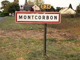 A roadsign, entering Montcorbon | ||
| ||
 Montcorbon Location within Centre-Val de Loire region  Montcorbon | ||
| Coordinates: 47°58′09″N 3°04′13″E / 47.9692°N 3.0703°ECoordinates: 47°58′09″N 3°04′13″E / 47.9692°N 3.0703°E | ||
| Country | France | |
| Region | Centre-Val de Loire | |
| Department | Loiret | |
| Arrondissement | Montargis | |
| Canton | Courtenay | |
| Government | ||
| • Mayor (2001–2007) | Jean-Claude Cloarec | |
| Area1 | 26.61 km2 (10.27 sq mi) | |
| Population (2012)2 | 461 | |
| • Density | 17/km2 (45/sq mi) | |
| Time zone | UTC+1 (CET) | |
| • Summer (DST) | UTC+2 (CEST) | |
| INSEE/Postal code | 45211 /45220 | |
| Elevation | 144–199 m (472–653 ft) | |
|
1 French Land Register data, which excludes lakes, ponds, glaciers > 1 km2 (0.386 sq mi or 247 acres) and river estuaries. 2 Population without double counting: residents of multiple communes (e.g., students and military personnel) only counted once. | ||
.svg.png)
Montcorbon is a former commune in the Loiret department in north-central France. On 1 January 2016, it was merged into the new commune of Douchy-Montcorbon.[1]
See also
References
- ↑ Arrêté préfectoral 30 November 2015
| Wikimedia Commons has media related to Montcorbon. |
This article is issued from
Wikipedia.
The text is licensed under Creative Commons - Attribution - Sharealike.
Additional terms may apply for the media files.