Monroe Township, Henry County, Ohio
| Monroe Township, Henry County, Ohio | |
|---|---|
| Township | |
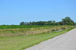 South Turkeyfoot Creek along 8 Road | |
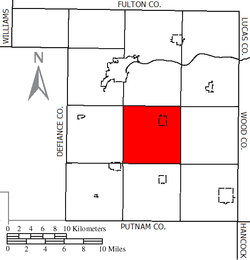 Location of Monroe Township in Henry County | |
| Coordinates: 41°17′54″N 84°3′33″W / 41.29833°N 84.05917°WCoordinates: 41°17′54″N 84°3′33″W / 41.29833°N 84.05917°W | |
| Country | United States |
| State | Ohio |
| County | Henry |
| Area | |
| • Total | 36.4 sq mi (94.4 km2) |
| • Land | 36.4 sq mi (94.4 km2) |
| • Water | 0.0 sq mi (0.0 km2) |
| Elevation[1] | 686 ft (209 m) |
| Population (2010) | |
| • Total | 1,142 |
| • Density | 31/sq mi (12.1/km2) |
| Time zone | UTC-5 (Eastern (EST)) |
| • Summer (DST) | UTC-4 (EDT) |
| FIPS code | 39-51408[2] |
| GNIS feature ID | 1086293[1] |
Monroe Township is one of the thirteen townships of Henry County, Ohio, United States. As of the 2010 census the population was 1,142,[3] of whom 877 lived in the unincorporated portion of the township.
Geography
Located in the central part of the county, it borders the following townships:
- Harrison Township - north
- Damascus Township - northeast corner
- Richfield Township - east
- Bartlow Township - southeast corner
- Marion Township - south
- Pleasant Township - southwest corner
- Napoleon Township - west
- Flatrock Township - northwest corner
Monroe Township is one of only two townships in the county without a border on another county.
The village of Malinta is located in northeastern Monroe Township, and the unincorporated community of Grelton lies on its border with Richfield Township.
Name and history
It is one of twenty-two Monroe Townships statewide.[4]
Government
The township is governed by a three-member board of trustees, who are elected in November of odd-numbered years to a four-year term beginning on the following January 1. Two are elected in the year after the presidential election and one is elected in the year before it. There is also an elected township fiscal officer,[5] who serves a four-year term beginning on April 1 of the year after the election, which is held in November of the year before the presidential election. Vacancies in the fiscal officership or on the board of trustees are filled by the remaining trustees.
References
- 1 2 "US Board on Geographic Names". United States Geological Survey. 2007-10-25. Retrieved 2008-01-31.
- ↑ "American FactFinder". United States Census Bureau. Retrieved 2008-01-31.
- ↑ "Geographic Identifiers: 2010 Census Summary File 1 (G001): Monroe township, Henry County, Ohio". American Factfinder. U.S. Census Bureau. Retrieved January 2, 2018.
- ↑ "Detailed map of Ohio" (PDF). United States Census Bureau. 2000. Retrieved 2007-02-16.
- ↑ §503.24, §505.01, and §507.01 of the Ohio Revised Code. Accessed 4/30/2009.
External links
Municipalities and communities of Henry County, Ohio, United States | ||
|---|---|---|
| City | 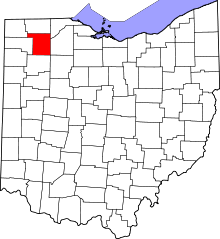 | |
| Villages | ||
| Townships | ||
| CDP | ||
| Unincorporated communities | ||
| Footnotes | ‡This populated place also has portions in an adjacent county or counties | |