Mondego River
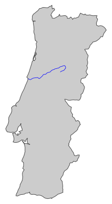
The Rio Mondego (Portuguese pronunciation: [mõˈdeɡu]; English language: Mondego River) is the longest river located exclusively in Portuguese territory.[1] It has its source in Serra da Estrela, the highest mountain range in mainland Portugal (i.e. except the Portuguese islands). It runs 234 kilometres (145 mi) from the Gouveia municipality, at 1,425 metres (4,675 ft) above sea level in Serra da Estrela, to its mouth in the Atlantic Ocean next to the city of Figueira da Foz.
It flows through the districts of Guarda, Viseu and Coimbra, all in Centro Region. It flows near the towns of Celorico da Beira, Fornos de Algodres, Nelas, Tabua, Carregal do Sal, Mortagua, Montemor-o-Velho and cities of Seia, Gouveia, Guarda, Oliveira do Hospital, Mangualde, Santa Comba Dao, before crossing the town of Penacova, is narrow, then widens by the city of Coimbra (with the University and the major urban area in Baixo Mondego), and the Montemor-o-Velho municipality (known for its castle and rice fields), before reaching the Atlantic at the city of Figueira da Foz.
There are 2 dams along the Mondego: Aguieira dam and Raiva dam.
Tributaries
One of its tributaries is the Rio Dão, which gives its name to the Dão DOC wine region. Another is the River Alva, which enters the Mondego just before Penacova. The Ceira River enters the Mondego just south of Coimbra along NH 17.[2]
Gallery
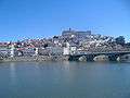 Coimbra and the Mondego
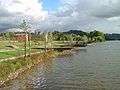 Mondego bank in Coimbra
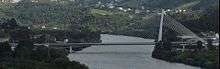 Rainha Santa bridge over the Mondego
 Mondego in Coimbra by night
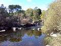 Mondego as it passes Caldas de Felgueira, Nelas, Portugal
See also
References
- ↑ "Mondego" by Manuel Pinheiro, Final Project of a masters's degree in Wildlife Documentary Production from the University of Salford. Film marked with a distinction. Filmed in Portugal during May/June 2011. A voyage by the Mondego river's wildlife from the mountains to the sea.
- ↑ "Google maps: 40° 11′ 2" N, 8° 23′ 46" W".
Coordinates: 40°12′47.41″N 8°20′41.25″W / 40.2131694°N 8.3447917°W