Moldo Too
| Moldo Too | |
|---|---|
|
Молдо тоосу | |
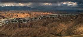 Moldo Too Mountains in the background rise above Naryn | |
| Highest point | |
| Elevation | 4,185 m (13,730 ft) |
| Dimensions | |
| Length | 110 km (68 mi) E-W |
| Width | 26 km (16 mi) N-S |
| Naming | |
| Etymology | in Kyrgyz "Молдо" meaning round, and "Тоо" - mountains |
| Geography | |
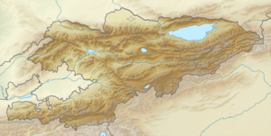 | |
| Country | Kyrgyzstan |
| State/Province | Naryn Province |
| Range coordinates | 41°35′N 74°40′E / 41.583°N 74.667°ECoordinates: 41°35′N 74°40′E / 41.583°N 74.667°E |
| Geology | |
| Type of rock |
Composed of sedimentary rocks of Middle Paleozoic |
The Moldo Too is a range in the Internal Tien Shan, Kyrgyzstan. It is mainly composed of limestones. The highest peak of the range is 4185 m.[1]
References
This article is issued from
Wikipedia.
The text is licensed under Creative Commons - Attribution - Sharealike.
Additional terms may apply for the media files.