Mita Station
A08 I04 Mita Station 三田駅 | |
|---|---|
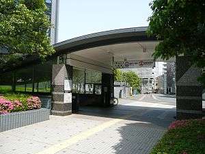 Station entrance A9, May 2011 | |
| Location |
5-34-10 (Asakusa Line) 5-18-8 (Mita Line) Shiba, Minato-ku, Tokyo Japan |
| Operated by | Tokyo Metropolitan Bureau of Transportation |
| Line(s) | |
| Other information | |
| Station code |
|
| History | |
| Opened | 1968 |
Mita Station (三田駅 Mita-eki) is a subway station in Minato, Tokyo, Japan, operated by Tokyo Metropolitan Bureau of Transportation (Toei). It is adjacent to Tamachi Station on the Yamanote Line and Keihin-Tōhoku Line and is a major station for commuters due to the proximity of many office and condominium developments. It is also the closest station to the main campus of Keio University.
Lines
Mita Station is served by the following lines.
- Toei Asakusa Line (with through services to Keikyu Main Line, Keisei Oshiage Line, Keisei Higashi-Narita Line, and Shibayama Railway Line)
- Toei Mita Line (with through services to Tokyu Meguro Line)
Station layout
The station consists of two sets of platforms, for the Asakusa Line and Mita Line. The Asakusa Line is served by an island platform (platforms 1 and 2) located on the second basement ("B2F") level, while the Mita Line is served by two side platforms located on separate levels, with the southbound platform (platform 3) on the second basement ("B2F") level, and the northbound platform (platform 4) on the third basement ("B3F") level.
Platforms
| 1 | A Toei Asakusa Line | for Sengakuji, Nishi-Magome Keikyu Main Line for Haneda Airport and Misakiguchi |
| 2 | A Toei Asakusa Line | for Nihombashi, Oshiage KS Keisei Line lines for Keisei-Takasago, Keisei-Tsudanuma and Narita Airport HSHokuso Railway for Imba-Nihon-Idai KS Narita Sky Access Line for Narita Airport |
| 3 | I Toei Mita Line | for Meguro MG Tokyu Meguro Line for Hiyoshi |
| 4 | I Toei Mita Line | for Ōtemachi, Sugamo, and Nishi-Takashimadaira |
Adjacent stations
| « | Service | » | ||
|---|---|---|---|---|
| Toei Asakusa Line A08 | ||||
| Sengakuji A07 | Airport Limited Express | Daimon A09 | ||
| Sengakuji A07 | - | Daimon A09 | ||
| Toei Mita Line I04 | ||||
| Shirokane-takanawa I03 | - | Shibakoen I05 | ||
History
The station opened on 21 June 1968, initially served only by the Toei Asakusa Line.[1] The Mita Line station opened on 27 November 1973.[1]
References
External links
| Wikimedia Commons has media related to Mita Station. |
- Toei Mita Station (in Japanese)
Coordinates: 35°38′53″N 139°44′56″E / 35.648174°N 139.748807°E