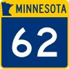
Minnesota State Highway 62 (Hennepin–Dakota counties)
| ||||
|---|---|---|---|---|
| Crosstown Highway | ||||
|
MN 62 highlighted in red | ||||
| Route information | ||||
| Maintained by MnDOT | ||||
| Length | 18.599 mi (29.932 km) | |||
| Existed | 1988 – present | |||
| Major junctions | ||||
| West end |
| |||
| ||||
| East end |
| |||
| Location | ||||
| Counties | Hennepin, Dakota | |||
| Highway system | ||||
| ||||
Minnesota State Highway 62 (MN 62) is a highway in the Twin Cities region of Minnesota. The route was part of Hennepin County Road 62 until 1988, when a portion of the route was inherited by the state. The western terminus of the route is at Interstate Highway 494 in Eden Prairie, where the roadway continues west as Hennepin County Road 62 to Hennepin County Road 101. The eastern terminus of the route is at the junction with Interstate 494 in Inver Grove Heights. Locally, the original portion of the route in Hennepin County is known as "the Crosstown," though signage with this name does not appear on the highway itself, but only on local streets adjacent to the road. It is also used as an alternate name, even by the Minnesota Department of Transportation. The route is 18.6 miles (29.9 km) in length.
Route description
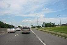
State Highway 62 serves as an east–west route between Eden Prairie, Minnetonka, Edina, Richfield, Minneapolis, Fort Snelling, Mendota Heights and Inver Grove Heights. The route is constructed to freeway standards for most of its length, except for the western 1/2 mile, which is an expressway with two signal-controlled intersections. The eastern section is also an expressway except for the last mile between Mendota Road and Interstate 494 which is again a freeway. The route is located in Hennepin and Dakota Counties.
Due to the existence of a second State Highway 62 in the southwest corner of the state between Fulda and Windom, the stretch of Highway 62 in the Twin Cities area starts its numbering at milepost 100. This is unorthodox in that the two state highways have a combined length of 36 miles (58 km). "Mile 100" is calibrated where Hennepin County Roads 101 and 62 meet at the Eden Prairie / Minnetonka boundary line; though the mileposts themselves, starting with mile 104, do not appear until the state-maintained section inside the I-494 beltway.
History
State Highway 62 in the Twin Cities area was authorized in 1988. Prior to 1988, the route was designated as Hennepin County Road 62. The route was built mostly in the late 1960s by Hennepin County.
The original Hennepin County numbering of 62 corresponded with 62nd Street in Minneapolis. However, some portions of Highway 62 do stray from the 62nd Street plane, as near the eastern terminus, Highway 62 runs along the plane of 58th Street.
Highway 62 previously had a traffic light at its eastern terminus at Highway 55 until an interchange was reconstructed during construction of the METRO Blue Line light rail in 2004.
I-35W and Highway 62 Crosstown Commons reconstruction project
The Twin Cities' Highway 62 had one of the most notorious junctions in the region where it interwove with Interstate Highway 35W. This mile-long stretch was known informally as the "Crosstown Commons". Plans to "unweave" and expand this section of roadway to improve traffic flow had come and gone for many years, frustrating the 200,000 drivers who used it daily. Construction of the current design was expected to begin in July 2006, but was delayed due to state budget deficits.
The project was adequately funded during Governor Tim Pawlenty's second term and bids were received in April 2007. The bid was won by the Ames, Lunda, and Schafer consortium for $288 million. Construction began in May 2007. The project included 25 new bridges, 63 lane-miles of highway, and expanded the total roadway width from 6 lanes to 12 lanes at Lyndale Avenue. The bridges were cast in Coates, Minnesota and trucked in for on-site erection. The new design includes transit / HOV lanes and was completed in November 2010.[1] The new interchange features three through-lanes for I-35W (including one HOV lane) in each direction and two separate through-lanes for Highway 62 in each direction, eliminating the need to weave across traffic. The 2007 cost of correcting the deficiencies in that short stretch of highway was estimated to be $285 million.[2]
Extension
In August 2018, Highway 62 was extended from its former eastern terminus at Highway 55 near the Mendota Bridge to a new terminus at Interstate 494 in the city of Inver Grove Heights. This new extension is cosigned as Highways 55/62 across the Mendota Bridge. Beyond the bridge, Highway 62 replaces the former Highway 110 in its entirety to Interstate 494. This project has been designated “One route. One name.” by MnDOT. The reason for the change was to assign a single highway number to this continuous route as opposed to the 3 different highway numbers (62-55-110) that the route formerly had. MnDOT believes this will lessen the potential for motorist confusion. Now Highway 62 in the Twin Cities area both originates and terminates at Interstate 494, travelling across Hennepin and Dakota Counties.
Exit list
Some exits have been numbered
| County | Location | mi[3] | km | Exit | Destinations | Notes |
|---|---|---|---|---|---|---|
| Hennepin | Eden Prairie–Minnetonka line | 103.592 | 166.715 | At-grade intersection; western terminus; road continues as CSAH 62 (62nd Street) | ||
| 104.727 | 168.542 | |||||
| Eden Prairie–Edina line | 105.867 | 170.376 | Cloverleaf interchange | |||
| 106.354 | 171.160 | Westbound exit and eastbound entrance | ||||
| Edina | 106.473 | 171.352 | ||||
| 107.369 | 172.794 | Tracy Avenue | ||||
| 108.342 | 174.360 | Cloverleaf interchange | ||||
| 109.183 | 175.713 | Valley View Road | Eastbound exit and westbound entrance | |||
| 109.422 | 176.098 | |||||
| Edina–Richfield– Minneapolis tripoint | 110.002 | 177.031 | ||||
| Richfield–Minneapolis line | 110.502 | 177.836 | ||||
| 111.278 | 179.085 | 111A/112A | I-35W exit 11; westbound entrance from I-35W NB includes direct entrance ramp from MN 121 | |||
| 111.538 | 179.503 | Lyndale Avenue | ||||
| 112.512 | 181.071 | No westbound entrance | ||||
| Minneapolis | 113.322 | 182.374 | Bloomington Avenue | Eastbound exit and entrance | ||
| 113.642 | 182.889 | |||||
| 114.367 | 184.056 | 28th Avenue | ||||
| 114.842 | 184.820 | 34th Avenue | ||||
| Unorganized Territory of Fort Snelling | 115.982 | 186.655 | 115 | (Former eastern terminus of MN-62) | ||
| 116.293 | 187.155 | 116A | Bloomington Road – Fort Snelling Historic Site | Ft. Snelling not signed eastbound | ||
| 116.454 | 187.415 | 116B/C | ||||
| Minnesota River | 116.479– 116.869 | 187.455– 188.082 | Mendota Bridge | |||
| Dakota | Mendota Heights | 116.946 | 188.206 | 117 | Eastbound exit and westbound entrance | |
| 117.333 | 188.829 | |||||
| 118.442 | 190.614 | I-35E north exit 101, south exits 101A-B; interchange | ||||
| 119.113 | 191.694 | |||||
| Inver Grove Heights | 121.416 | 195.400 | Interchange | |||
| 122.191 | 196.647 | I-494 exit 67; eastbound exit and westbound entrance | ||||
| 1.000 mi = 1.609 km; 1.000 km = 0.621 mi | ||||||
References
- ↑ Olson, Dan (May 15, 2007). "Untangling the infamous Crosstown Commons now underway". Minnesota Public Radio. Retrieved May 31, 2007.
- ↑ "MnDOT invites contractors to bid on I-35W/Crosstown project". Minnesota Department of Transportation. Archived from the original on August 20, 2007. Retrieved May 31, 2007.
- ↑ Minnesota Department of Transportation. "Statewide Trunk Logpoint Listing" (PDF). St. Paul: Minnesota Department of Transportation. Retrieved August 1, 2018.
External links
Route map: