Miller Spur (Graham Land)
Miller Spur (Bulgarian: рид Милер, ‘Rid Miller’ \'rid 'mi-ler\ is the narrow rocky ridge of elevation 1600 m projecting from Detroit Plateau 2.9 km west-northwestwards into upper Cayley Glacier on Danco Coast in Graham Land, Antarctica.
The ridge is named after the German geologist Hubert Miller, researcher at St. Kliment Ohridski base in 2001/02 season, for his support for the Bulgarian Antarctic programme.
Location
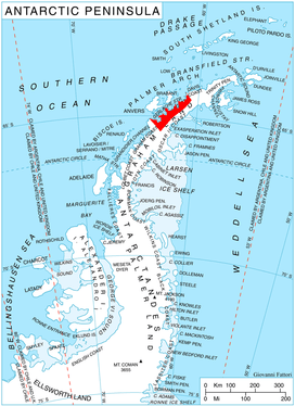
Miller Spur is located at 64°29′02″S 60°40′13″W / 64.48389°S 60.67028°WCoordinates: 64°29′02″S 60°40′13″W / 64.48389°S 60.67028°W, which is 15.85 km east of Obretenik Bastion, 7.13 km south-southeast of Mount Berry, 2.4 km southwest of the parallel Davidov Spur, and 12 km north of Glazne Buttress on Nordenskjöld Coast. British mapping in 1978.
Maps
- British Antarctic Territory. Scale 1:200000 topographic map. DOS 610 Series, Sheet W 64 60. Directorate of Overseas Surveys, Tolworth, UK, 1978.
- Antarctic Digital Database (ADD). Scale 1:250000 topographic map of Antarctica. Scientific Committee on Antarctic Research (SCAR). Since 1993, regularly upgraded and updated.
References
- Bulgarian Antarctic Gazetteer. Antarctic Place-names Commission. (details in Bulgarian, basic data in English)
- Miller Spur. SCAR Composite Gazetteer of Antarctica
This article includes information from the Antarctic Place-names Commission of Bulgaria which is used with permission.