Davidov Spur
Davidov Spur (Bulgarian: Давидов рид, ‘Davidov Rid’ \da-'vi-dov 'rid\ is the narrow rocky ridge of elevation 1400 m projecting from Detroit Plateau 2.75 km west-northwestwards into upper Cayley Glacier on Danco Coast in Graham Land, Antarctica.
The ridge is named after Niki Davidov, photographer at St. Kliment Ohridski base in 2000/01 and 2009/10 seasons, for his work on promoting awareness and appreciation of Antarctica.
Location
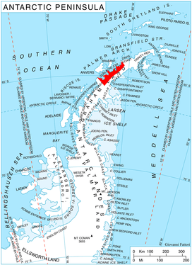
Davidov Spur is located at 64°28′23″S 60°37′40″W / 64.47306°S 60.62778°WCoordinates: 64°28′23″S 60°37′40″W / 64.47306°S 60.62778°W, which is between the parallel Galabinov Spur and Miller Spur that lie 1.75 km to the northeast and 2.4 km to the southwest respectively, 7.45 km southeast of Mount Berry, and 13.4 km WNW of Batkun Peak on Nordenskjöld Coast. British mapping in 1978.
Maps
- British Antarctic Territory. Scale 1:200000 topographic map. DOS 610 Series, Sheet W 64 60. Directorate of Overseas Surveys, Tolworth, UK, 1978.
- Antarctic Digital Database (ADD). Scale 1:250000 topographic map of Antarctica. Scientific Committee on Antarctic Research (SCAR). Since 1993, regularly upgraded and updated.
References
- Bulgarian Antarctic Gazetteer. Antarctic Place-names Commission. (details in Bulgarian, basic data in English)
- Davidov Spur. SCAR Composite Gazetteer of Antarctica.
This article includes information from the Antarctic Place-names Commission of Bulgaria which is used with permission.