Mill Gap, Virginia
| Mill Gap, Virginia | |
|---|---|
| Unincorporated community | |
_between_Wade_Woods_Lane_and_Virginia_State_Secondary_Route_604_in_Mill_Gap%2C_Highland_County%2C_Virginia.jpg) | |
 Mill Gap  Mill Gap | |
| Coordinates: 38°19′18″N 79°42′14″W / 38.32167°N 79.70389°WCoordinates: 38°19′18″N 79°42′14″W / 38.32167°N 79.70389°W | |
| Country | United States |
| State | Virginia |
| County | Highland |
| Elevation | 2,533 ft (772 m) |
| Time zone | UTC-5 (Eastern (EST)) |
| • Summer (DST) | UTC-4 (EDT) |
| ZIP code | 24465 |
| Area code(s) | 540 |
| GNIS feature ID | 1497017[1] |
Mill Gap (also Green Hill, Millgap, or Rucksmanville) is an unincorporated community in Highland County, Virginia, United States. Mill Gap is located 9.1 miles (14.6 km) southwest of Monterey, Virginia on Virginia State Route 84.[2] The community is located near a water gap of the same name that separates the ridges of Lantz Mountain and Little Mountain through which the East Back Creek flows.[3][4]
References
- ↑ "Mill Gap". Geographic Names Information System. United States Geological Survey.
- ↑ Google (15 December 2012). "Mill Gap, Virginia" (Map). Google Maps. Google. Retrieved 15 December 2012.
- ↑ "The National Map". United States Geological Survey. Retrieved February 13, 2014.
- ↑ Morton, Oren Frederic (1911). A History of Highland County, Virginia. p. 10.
Municipalities and communities of Highland County, Virginia, United States | ||
|---|---|---|
| Town | 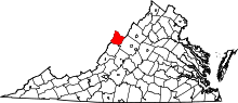 | |
| Unincorporated communities | ||
| Footnotes | ‡This populated place also has portions in an adjacent county or counties | |
This article is issued from
Wikipedia.
The text is licensed under Creative Commons - Attribution - Sharealike.
Additional terms may apply for the media files.