Metro Zaragoza
Zaragoza | |||||||||||
|---|---|---|---|---|---|---|---|---|---|---|---|
| STC rapid transit | |||||||||||
 | |||||||||||
| Coordinates | 19°25′11″N 99°05′45″W / 19.41967°N 99.09595°WCoordinates: 19°25′11″N 99°05′45″W / 19.41967°N 99.09595°W | ||||||||||
| Platforms | 2 | ||||||||||
| Tracks | 2 | ||||||||||
| History | |||||||||||
| Opened | 5 September 1969 | ||||||||||
| Services | |||||||||||
| |||||||||||
Metro Zaragoza is a station on the Mexico City Metro.[1][2] It is located in the Colonia 4 arboles and Colonia Puebla neighbourhoods of Venustiano Carranza borough, to the east of downtown Mexico City.[1] It is on Line 1.[1][2]
Iconography
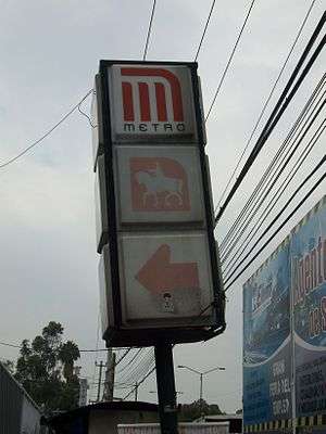
The station is named after General Ignacio Zaragoza, commander of the Mexican troops that defeated the French invaders at the Battle of Puebla and the nearby Avenida Ignacio Zaragoza. The station logo depicts this Mexican military genius astride his horse.[1][2]
General information
The station was opened on 5 September 1969 and it initially served as the eastern terminus of Line 1.[3]
Although Metro Zaragoza is no longer the terminal station for Line 1 (usurped by Metro Pantitlán since the extension of the line in 1984[3]) its role as an important station still remains. It serves as the interconnection point for many suburban bus lines that dissipate into the suburban eastern reaches of the state of México.
Near this station are the facilities of "Expo Metro", a display about the metro, its rolling stock, how it works, history and more.
References
- 1 2 3 4 "Zaragoza" (in Spanish). Archived from the original on 28 September 2011. Retrieved 15 August 2011.
- 1 2 3 Archambault, Richard. "Zaragoza » Mexico City Metro System". Retrieved 15 August 2011.
- 1 2 Monroy, Marco. Schwandl, Robert, ed. "Opening Dates for Mexico City's Subway". Retrieved 15 August 2011.
External links
| Wikimedia Commons has media related to Zaragoza (station). |
| Stations |  | |
|---|---|---|
| Transfer Stations | ||