Metro Santa Marta
Santa Marta | |||||||||||
|---|---|---|---|---|---|---|---|---|---|---|---|
| STC rapid transit | |||||||||||
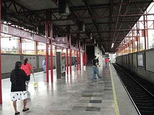 Island platform at Santa Marta | |||||||||||
| Location |
Mexico City Mexico | ||||||||||
| Coordinates | 19°21′36″N 98°59′42″W / 19.36°N 98.994863°WCoordinates: 19°21′36″N 98°59′42″W / 19.36°N 98.994863°W | ||||||||||
| Line(s) |
| ||||||||||
| Platforms | 1 island platform | ||||||||||
| Tracks | 2 | ||||||||||
| History | |||||||||||
| Opened | 1991 | ||||||||||
| Services | |||||||||||
| |||||||||||
Santa Marta (also known as Spanish: Estación Santa Martha) is a station along Line A of the Mexico City Metro.[1][2] It is located in the Colonia Ermita Zaragoza neighborhood of the Iztapalapa borough in Mexico City.[1]
The logo of the station depicts a silhouette of Saint Martha with a pitcher in her hands.[1][2]
Exits
- Northwest: Generalísimo Morelos street and Rocha and Pardiñas streets, Col. Ermita Zaragoza
- Northeast: Generalísimo Morelos street and Galeana street, Col. Ermita Zaragoza
- Southeast: Calzada Ignacio Zaragoza, Col. Lomas de Zaragoza
References
- 1 2 3 "Santa Marta" (in Spanish). Archived from the original on 10 March 2011. Retrieved 6 August 2011.
- 1 2 Archambault, Richard. "Santa Marta » Mexico City Metro System". Retrieved 6 August 2011.
External links

| Stations | ||
|---|---|---|
| Transfer Stations | ||
This article is issued from
Wikipedia.
The text is licensed under Creative Commons - Attribution - Sharealike.
Additional terms may apply for the media files.