Kelsey Creek
| Kelsey Creek | |
 Kelsey Creek in Bellevue's Crossroads neighborhood | |
| Country | United States |
|---|---|
| State | Washington |
| Region | King County |
| Source | Lake Hills Greenbelt |
| - location | Bellevue, Washington |
| Source confluence | |
| - coordinates | 47°36′37″N 122°08′24″W / 47.61028°N 122.14000°W |
| Mouth | |
| - location | Lake Washington |
| - elevation | 16 ft (5 m) |
| - coordinates | 47°36′01″N 122°09′58″W / 47.60028°N 122.16611°WCoordinates: 47°36′01″N 122°09′58″W / 47.60028°N 122.16611°W |
| Basin | 17.0 sq mi (44 km2) [1] |
| Discharge | |
| - average | 22.5 cu ft/s (1 m3/s) [2] |
| - max | 832 cu ft/s (24 m3/s) |
| - min | 1.9 cu ft/s (0 m3/s) |
Kelsey Creek is a creek in Bellevue, Washington on Seattle's Eastside. Originating in the wetlands in the Lake Hills greenbelt between Phantom Lake and Larsen Lake, it flows north to the Spring District then south through Kelsey Creek Park where it turns west and becomes the Mercer Slough just west of Interstate 405. The centerpiece of the largest wetland adjacent to Lake Washington (367 acres), the slough empties into the East Channel of Lake Washington at Interstate 90.
The Kelsey Creek drainage basin is about 10,870 acres,[1] including about 75% of the city of Bellevue in addition to a portion of Redmond.[3] Tributaries include Valley Creek, Goff Creek, the West Tributary, Sturtevant Creek, Richards Creek, East Creek, and Sunset Creek.[1] Kelsey Creek flows into the head of the Mercer Slough through a large concrete culvert which has been built to allow salmon to ascend easily via a few short drops of the creek.[3]
Historically, the Kelsey Creek drainage basin included what is now Phantom Lake. In the late 1800s, however, farmer Henry Thode redirected the Phantom Lake outlet to Lake Sammamish, resulting in a reduced water flow to Kelsey Creek.[4]
For centuries, the Mercer Slough wetlands had been a swamp, marsh, and shallow water area, with the Mercer Slough itself being a shallow inlet of Lake Washington. Following the completion of the Lake Washington Ship Canal and Hiram M. Chittenden Locks in 1917, the water level of Lake Washington was lowered 8.8 feet (2.7 m) exposing the lake bed along the course of the present-day slough. The Mercer Slough was partially dredged in the 1920s to make it navigable to small watercraft. Today, canoes can be rented to explore the lower waterway.[3]
 Larsen Lake, near the Kelsey Creek source and a part of the Kelsey Creek drainage basin
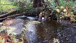
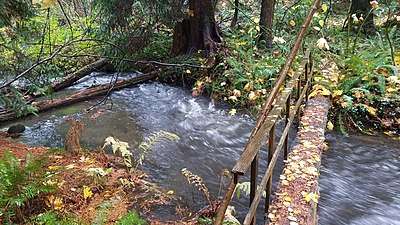 Kelsey Creek in the Crossroads area following a fall rain storm
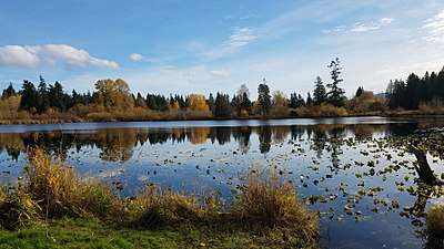
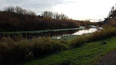 The Mercer Slough, about a mile upstream from its terminus at Lake Washington
See also
References
- 1 2 3 "Kelsey Creek (Sites 0444 D444)". Retrieved 2007-12-24.
- ↑ "Water Resources Data-Washington Water Year 2005; Lake Washington Basins" (PDF). USGS. Retrieved 3 August 2009.
- 1 2 3 Johnston, Greg (August 12, 1999). "Urban oasis: Mercer Slough offers quiet respite amid the concrete jungle". The Seattle Post-Intelligencer. Archived from the original on October 15, 2002. Retrieved January 22, 2018.
- ↑ "Weowna Creek Restoration -- High Tech - Low Impact". Retrieved 2007-08-15.
External links
| Wikimedia Commons has media related to Kelsey Creek. |