Melrose Historic District
|
Melrose Historic District | |
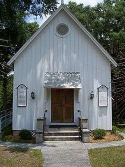 Trinity Episcopal Church, in the district | |
  | |
| Location | Melrose, Florida |
|---|---|
| Coordinates | 29°42′45″N 82°3′3″W / 29.71250°N 82.05083°WCoordinates: 29°42′45″N 82°3′3″W / 29.71250°N 82.05083°W |
| Area | 250 acres (100 ha) |
| NRHP reference # | 89002305[1] |
| Added to NRHP | January 12, 1990 |
The Melrose Historic District is a 250-acre (100 ha) U.S. historic district in Melrose, Florida that was listed on the National Register of Historic Places in 1990. It is bounded by Seminole Ridge Road, Grove Street, South Street, Quail Street, and Melrose Bay. In 1990 it contained 65 contributing buildings and one contributing site, and 21 non-contributing buildings.[1]
See also
References
| Wikimedia Commons has media related to Melrose Historic District. |
- 1 2 National Park Service (2010-07-09). "National Register Information System". National Register of Historic Places. National Park Service.
- ↑ Murray P. Lanrie and Barbara R. Mattick (December 1989). "National Register of Historic Places Registration: Melrose Historic District". National Park Service. Retrieved March 10, 2017. with 18 photos
External links
- Florida's Office of Cultural and Historical Programs - Alachua County
- Historic Markers in Alachua County


Alachua County architectural survey: Waldo, Archer, Melrose et cetera, 1973: Alachua County survey of historic buildings and architecture - photos, description, history, owners, valuations, condition, general reports especially valuable for original owner information and succeeding owners. In Melrose approximately 42 buildings described - see Melrose pages 26-68 of 94 total pages. University of Florida Dept. or Architecture. . http://ufdc.ufl.edu/UF00103201/00001/1x?search=melrose