Melnsils
| Melnsils Livonian: Mustānum | |
|---|---|
| Village | |
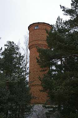 Melnsils water tower. | |
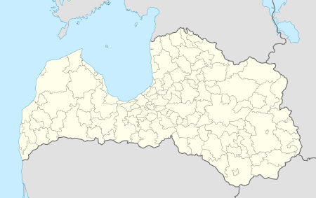 Melnsils Location in Latvia | |
| Coordinates: 57°39′09.4″N 22°34′25.0″E / 57.652611°N 22.573611°ECoordinates: 57°39′09.4″N 22°34′25.0″E / 57.652611°N 22.573611°E | |
| Country |
|
| Municipality | Roja Municipality |
| Elevation | 43 ft (13 m) |
| Population (2015) | |
| • Total | 164 |
| Time zone | UTC+2 (EET) |
| • Summer (DST) | UTC+3 ( EEST) |
| Postal code | LV-3276 Melnsils |
Melnsils (Livonian: Mustānum) is a populated place in Roja municipality, Latvia. One of the twelve Livonian villages on Līvõd Rānda - the Livonian Coast. Other names: Melnsil, Melsils.
Melnsils camping
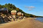
Melnsils camping site near sea coast.
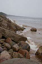
Melnsils coastline near camp area.
Melnsils camping site is located right by the sea, just 10 km away from Kolka, near the Slītere National Park, the sea-cliffs, and fascinating walking paths in the woods. It is located about 1 km from the highway P131.
Melnsils camping site is ideal for recreational activities and organization of sports events for up to 300 persons.
Climate
The continental climate prevails in the area. The annual average temperature is 6 ° C. The warmest month is August, when the average temperature is 17 ° C, and the coldest is January, with -4 ° C. [1]
References
External links
See also
Livonian villages on Līvõd Rānda – the Livonian Coast | |||
|---|---|---|---|
This article is issued from
Wikipedia.
The text is licensed under Creative Commons - Attribution - Sharealike.
Additional terms may apply for the media files.