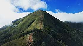
Meesapulimala
| Meesapulimala | |
|---|---|
 | |
| Highest point | |
| Elevation | 2,640 m (8,660 ft) [1] |
| Coordinates | 10°05′51″N 77°12′12″E / 10.097403°N 77.203417°ECoordinates: 10°05′51″N 77°12′12″E / 10.097403°N 77.203417°E |
| Geography | |
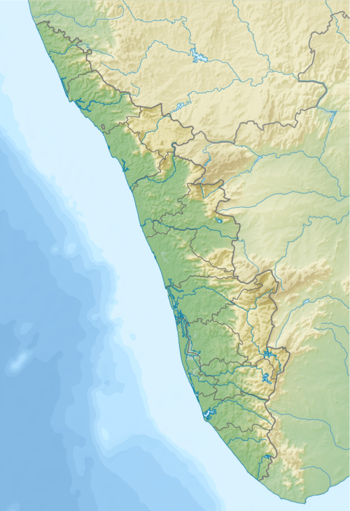 Meesapulimala Border of Devikulam taluk, Udumbanchola taluk, Idukki district, Kerala and Bodinayakanur taluk, Theni district, Tamil Nadu, India | |
| Parent range | Western Ghats |
| Climbing | |
| Easiest route | Kochi --> Adimaly-->Munnar --> Meesapulimala |
Meesapulimala (Malayalam: മീശപ്പുലിമല) is the second highest peak in the Western Ghats of Idukki district (Kerala) on the Indian subcontinent after Anamudi. Its peak is 2,640 metres (8,661 ft) above sea level.[2] The name derives from the fact that it is formed of eight peaks which spread like a "Moustache" and it is located in between the Anaimalai Hills and Palani Hills near Suryanelli around 20km away from Munnar. Kolukkumalai tea estate, Top Station and Tipadamala (2135m) is also nearby.
Treks to the peak via Rhodo Valley (favourable for rhododendron flowers) can be organized through the Kerala Forest Development Corporation in Munnar.[3]
Meesapulimala trekking booking is limited[4] and the trekking path from Kolukkumalai to Meesapulimala is highly restricted.
There is a great chance of sighting wildlife including Nilgiri Thar, Sambar Deer, Wild Gaur, Wild Dogs and even the Sloth Bear. The duration totally depends on your physical fitness. It will take about 7 to 9 hours to complete the full route.
Citations
- ↑ U.S.Army Map Service (LU), Corps of Engineers
- ↑ toposheet prepared by the Army Map Service (LU), Corps of Engineers, U.S. Army, Washington
- ↑ "Rhodo Valley - Rhodo Mansion". Kerala Forest Development Corporation Ltd. Retrieved 2017-11-02.
- ↑ "Meesapulimala Trekking".
| Wikimedia Commons has media related to Meesapulimala. |