Mearim River
| Mearim River | |
|---|---|
 The Mearim River | |
 Mouth location in Brazil | |
| Country | Brazil |
| Physical characteristics | |
| River mouth | 3°04′06″S 44°35′04″W / 3.068381°S 44.584363°WCoordinates: 3°04′06″S 44°35′04″W / 3.068381°S 44.584363°W |
| Basin features | |
| River system | Baía de São Marcos |
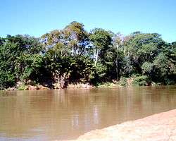
The Mearim River is a river in Maranhão state of northern Brazil. The river originates in the southern part of Maranhão, and drains north into the Baía de São Marcos, an estuary that also receives the Pindaré and Grajaú rivers, which are sometimes considered tributaries of the Mearim. The lower Mearim is known for its pororoca, or tidal bore.
The Mearim is approximately 800 kilometers long, flowing through the marshlands of the Atlantic Coastal Plain. It meets the Atlantic Ocean at the Sao Marcos Bay, where it forms a common estuary with another river, Pindare. The Mearim's primary source of water is rain. The river's upper and middle courses are characterized by rapids. Only the lower sections of the Mearim are suitable for navigation.[1] The river defines the southern boundary of the Tocantins-Araguaia-Maranhão moist forests ecoregion.[2]
References
- ↑ "Mearim". Farlex, Inc. Retrieved 10 July 2013.
- ↑ "Tocantins/Pindare moist forests", Global Species, Myers Enterprises II, retrieved 2017-03-24