McGuire Island (Oregon)
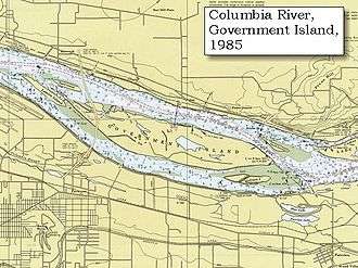 Map of Government Island and surrounding islands. McGuire Island is the southernmost island before the mainland. | |
| Geography | |
|---|---|
| Coordinates | 45°33′49″N 122°27′54″W / 45.56361°N 122.46500°WCoordinates: 45°33′49″N 122°27′54″W / 45.56361°N 122.46500°W |
| Adjacent bodies of water | Columbia River |
| Area | 9.3 ha (23 acres) |
| Highest elevation | 7 m (23 ft) |
| Administration | |
| State | Oregon |
| County | Multnomah |
| Demographics | |
| Population | 0 |
McGuire Island is an island in the Columbia River in Multnomah County, Oregon. It is located southeast of Government Island.[1]
McGuire Island was purchased by the Port of Portland in 1969 and is patrolled by the Multnomah County Sheriff's Office.[2]
References
- ↑ "Government Island State Recreation Area - Park History". Oregon State Parks. Retrieved November 12, 2016.
- ↑ Hall, Kasia (August 28, 2014). "Multnomah County Sheriff's Office outlines enforcement guidelines for Columbia River islands after recent violence". The Oregonian (Oregonlive.com). Retrieved November 12, 2016.
This article is issued from
Wikipedia.
The text is licensed under Creative Commons - Attribution - Sharealike.
Additional terms may apply for the media files.