McElmo Creek
| McElmo Creek[1] | |
|---|---|
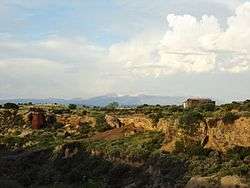 McElmo Creek, with the La Plata Mountains | |
| Physical characteristics | |
| Main source | 37°21′33″N 108°29′10″W / 37.35917°N 108.48611°W |
| River mouth |
Confluence with San Juan 4,462 ft (1,360 m) 37°12′52″N 109°11′33″W / 37.21444°N 109.19250°WCoordinates: 37°12′52″N 109°11′33″W / 37.21444°N 109.19250°W |
| Basin features | |
| Progression | San Juan—Colorado |
| Basin size | 711 sq mi (1,840 km2) |
McElmo Creek is a 70.1-mile-long (112.8 km)[2] tributary that joins the San Juan River in San Juan County, Utah. The creek's source is just east of Cortez in Montezuma County, Colorado.
The flow in McElmo Creek increased after water was diverted out of the Dolores River just downstream of Dolores by construction of the Montezuma Tunnel in 1889. The Montezuma Tunnel and the subsequent project including Lake McPhee irrigated the dry Montezuma Valley. This irrigation resulted in new water flows to McElmo Creek from flood irrigation waste water, from canal leakage and sluicing and from higher ground water levels.
The U.S. Fish and Wildlife Service installed a PIT antenna on McElmo Creek in 2012. The antenna monitors movement of tagged endangered fishes.[3]
See also
References
- ↑ "McElmo Creek". Geographic Names Information System. United States Geological Survey. Retrieved 2011-01-30.
- ↑ U.S. Geological Survey. National Hydrography Dataset high-resolution flowline data. The National Map Archived 2012-04-05 at WebCite, accessed March 21, 2011
- ↑ "PIT Tag Antenna Systems Provide New Data for the San Juan Recovery Program", Mark McKinstry and Peter MacKinnon, Swimming Upstream Newsletter, Winter 2014