McCalla Field
| McCalla Field Naval Station Guantanamo Bay | |||||||||||
|---|---|---|---|---|---|---|---|---|---|---|---|
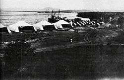 1913 image of aviation facilities at Fisherman's Point | |||||||||||
| Summary | |||||||||||
| Airport type | Military | ||||||||||
| Operator | United States Navy | ||||||||||
| Location | Guantánamo Bay, Cuba | ||||||||||
| Elevation AMSL | 60 ft / 18 m | ||||||||||
| Coordinates | 19°54′41.39″N 075°9′48.33″W / 19.9114972°N 75.1634250°WCoordinates: 19°54′41.39″N 075°9′48.33″W / 19.9114972°N 75.1634250°W | ||||||||||
| Map | |||||||||||
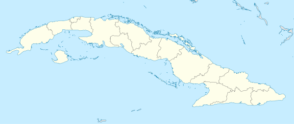 MUGM Location in Cuba | |||||||||||
| Runways | |||||||||||
| |||||||||||
McCalla Field was a U.S. military airfield located at Naval Station Guantanamo Bay in Guantánamo Bay, Cuba. The airfield was named for Bowman H. McCalla, who was a United States Navy admiral in charge of the Battle of Guantánamo Bay. The current field was expanded in 1941 when the original grass runway was replaced.[3] Aviation facilities in the area first appeared in 1913 with a naval aviation camp .
Facilities
The airport resides at an elevation of 60 ft (18 m) above mean sea level. The airfield was de-activated in the 1970s but has been used to house refugees beginning in the 1990s and lasted until 2007.[4]
The USN aviation assets are now located across the bay at Leeward Point Field.
References
- ↑ Airport information for MUGM at World Aero Data. Data current as of October 2006.Source: DAFIF.
- ↑ Airport information for NBW at Great Circle Mapper. Source: DAFIF (effective October 2006).
- ↑ "Guantanamo Bay Forts". www.northamericanforts.com.
- ↑ "Guantánamo Public Memory Project – Repurposing Gitmo". blog.gitmomemory.org.
External links
| Wikimedia Commons has media related to Aviation at Naval Base Guantanamo Bay. |
This article is issued from
Wikipedia.
The text is licensed under Creative Commons - Attribution - Sharealike.
Additional terms may apply for the media files.