Maure-de-Bretagne
| Maure-de-Bretagne Anast | ||
|---|---|---|
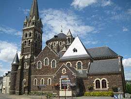 The church in Maure-de-Bretagne | ||
| ||
 Maure-de-Bretagne Location within Brittany region  Maure-de-Bretagne | ||
| Coordinates: 47°53′30″N 1°59′25″W / 47.8917°N 1.9903°WCoordinates: 47°53′30″N 1°59′25″W / 47.8917°N 1.9903°W | ||
| Country | France | |
| Region | Brittany | |
| Department | Ille-et-Vilaine | |
| Arrondissement | Redon | |
| Canton | Guichen | |
| Area1 | 66.76 km2 (25.78 sq mi) | |
| Population (2008)2 | 3,142 | |
| • Density | 47/km2 (120/sq mi) | |
| Time zone | UTC+1 (CET) | |
| • Summer (DST) | UTC+2 (CEST) | |
| INSEE/Postal code | 35168 /35330 | |
| Elevation | 17–117 m (56–384 ft) | |
|
1 French Land Register data, which excludes lakes, ponds, glaciers > 1 km2 (0.386 sq mi or 247 acres) and river estuaries. 2 Population without double counting: residents of multiple communes (e.g., students and military personnel) only counted once. | ||
.svg.png)
Maure-de-Bretagne (Breton: Anast, Gallo: Maurr) is a former commune in the Ille-et-Vilaine department in Brittany in northwestern France. On 1 January 2017, it was merged into the new commune Val d'Anast.[1]
Population
Inhabitants of Maure-de-Bretagne are called Mauritaniens in French.
| Historical population | ||
|---|---|---|
| Year | Pop. | ±% |
| 1962 | 2,492 | — |
| 1968 | 2,646 | +6.2% |
| 1975 | 2,516 | −4.9% |
| 1982 | 2,496 | −0.8% |
| 1990 | 2,552 | +2.2% |
| 1999 | 2,470 | −3.2% |
| 2008 | 3,142 | +27.2% |
See also
References
- ↑ Arrêté préfectoral 29 August 2016 (in French)
- Mayors of Ille-et-Vilaine Association (in French)
External links
| Wikimedia Commons has media related to Maure-de-Bretagne. |
- Official website (in French)
- French Ministry of Culture list for Maure-de-Bretagne (in French)
| Authority control |
|---|
This article is issued from
Wikipedia.
The text is licensed under Creative Commons - Attribution - Sharealike.
Additional terms may apply for the media files.