Massachusetts Route 240
| ||||
|---|---|---|---|---|
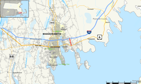 Map of Bristol County in southeastern Massachusetts with Route 240 highlighted in red | ||||
| Route information | ||||
| Length | 1.3 mi[1] (2.1 km) | |||
| Major junctions | ||||
| South end |
| |||
| North end |
| |||
| Location | ||||
| Counties | Bristol | |||
| Highway system | ||||
| ||||

Route 240 is a short south–north state highway in southeastern Massachusetts.
Route description
Route 240 acts as a connector between U.S. Route 6 and I-195 in Fairhaven. There are ghost ramps at the northern end of the highway that show that Route 240 was intended to continue north of I-195 to Acushnet, which was originally planned in the 1970s, but lost traction over the years.[2] An aerial view of the northern terminus hints of a continuation beyond that point.[3] Most maps indicate that this divided highway is one that has limited access, but that is not true as there is an at-grade intersection with traffic signals at Bridge Street, just north of U.S. 6.
Major intersections
The entire route is in Fairhaven, Bristol County.
| mi[1][4] | km | Destinations | Notes | ||
|---|---|---|---|---|---|
| 0.0 | 0.0 | At-grade intersection | |||
| 0.469 | 0.755 | Bridge Street | At-grade intersection; south end of freeway section | ||
| 0.9 | 1.4 | Exit 18 on I-195 | |||
| 1.0 | 1.6 | ||||
| 1.000 mi = 1.609 km; 1.000 km = 0.621 mi | |||||
See also
References
- 1 2 Google (20 May 2013). "Massachusetts Route 240" (Map). Google Maps. Google. Retrieved 20 May 2013.
- ↑ Jope, Amy (22 May 1997). "Fairhaven selectmen reject Route 240 extension". New Bedford Standard-Times. Retrieved 26 February 2013.
- ↑ Aerial View of Route 240 and I-195
- ↑ "Massachusetts Route Log Applicaton". Massachusetts Department of Transportation. Retrieved January 7, 2018.
External links
This article is issued from
Wikipedia.
The text is licensed under Creative Commons - Attribution - Sharealike.
Additional terms may apply for the media files.