Maryneal, Texas
| Maryneal | |
|---|---|
| Unincorporated community | |
 Maryneal Location within the state of Texas  Maryneal Maryneal (the US) | |
| Coordinates: 32°14′7″N 100°27′1″W / 32.23528°N 100.45028°WCoordinates: 32°14′7″N 100°27′1″W / 32.23528°N 100.45028°W | |
| Country | United States |
| State | Texas |
| County | Nolan |
| Elevation | 2,566 ft (782 m) |
| Time zone | UTC-6 (Central (CST)) |
| • Summer (DST) | UTC-5 (CDT) |
| ZIP codes | 79535 |
| GNIS feature ID | 1341044 |
Maryneal is an unincorporated community in southern Nolan County, Texas, United States. It lies along FM 608 south of the city of Sweetwater, the county seat of Nolan County.[1] Its elevation is 2,566 feet (782 m).[2] Although Maryneal is unincorporated, it has a post office, with the ZIP code of 79535;[3] the ZCTA for ZIP Code 79535 had a population of 181 at the 2000 census.[4]
Founded in 1907 along the Kansas City, Mexico and Orient Railway, the community was named for one or more people; the source of its name is disputed. In its early history, the community was more significant than it is today: it won a significant minority of the votes in an election (losing to Sweetwater) to determine the county seat, and a post office was established in Maryneal by being moved from Decker.[5]
References
- ↑ Rand McNally. The Road Atlas '08. Chicago: Rand McNally, 2008, pp. 98-99.
- ↑ U.S. Geological Survey Geographic Names Information System: Maryneal, Texas
- ↑ Zip Code Lookup
- ↑ "American FactFinder". United States Census Bureau. Retrieved 2008-01-31.
- ↑ Maryneal, Texas, Handbook of Texas Online, 2008-01-18. Accessed 2008-08-10.
External links
Municipalities and communities of Nolan County, Texas, United States | ||
|---|---|---|
| Cities | 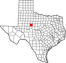 | |
| Unincorporated communities | ||
| Ghost towns | ||
| Footnotes | ‡This populated place also has portions in an adjacent county or counties | |