Martin Township, Michigan
| Martin Township, Michigan | |
|---|---|
| Township | |
 Martin Township Location within the state of Michigan | |
| Coordinates: 42°33′10″N 85°36′26″W / 42.55278°N 85.60722°WCoordinates: 42°33′10″N 85°36′26″W / 42.55278°N 85.60722°W | |
| Country | United States |
| State | Michigan |
| County | Allegan |
| Area | |
| • Total | 36.0 sq mi (93.2 km2) |
| • Land | 35.5 sq mi (92.0 km2) |
| • Water | 0.4 sq mi (1.1 km2) |
| Elevation | 774 ft (236 m) |
| Population (2010) | |
| • Total | 2,629 |
| • Density | 74/sq mi (28.6/km2) |
| Time zone | UTC-5 (Eastern (EST)) |
| • Summer (DST) | UTC-4 (EDT) |
| ZIP code |
49070 (Martin), 49080 (Plainwell), 49344 (Shelbyville) |
| Area code(s) | 269 |
| FIPS code | 26-52000[1] |
| GNIS feature ID | 1626701[2] |
| Website |
www |
Martin Township is a civil township of Allegan County in the U.S. state of Michigan. The population was 2,629 at the 2010 census.[3]
Communities
The village of Martin is within the township. The Martin ZIP code 49070 serves a large portion of Martin Township.[4]
The city of Plainwell is to the south, and the Plainwell ZIP code 49080 also serves the southeast corner of Martin Township.[5]
Shelbyville is a small unincorporated community in the north of the township on the boundary with Wayland Township. The Shelbyville ZIP code 49344 also serves parts of northern Martin Township.[6]
Geography
According to the United States Census Bureau, the township has a total area of 36.0 square miles (93.2 km2), of which 35.5 square miles (92.0 km2) is land and 0.42 square miles (1.1 km2), or 1.22%, is water.[3]
Demographics
| Historical population | |||
|---|---|---|---|
| Census | Pop. | %± | |
| 1960 | 1,963 | — | |
| 1970 | 2,125 | 8.3% | |
| 1980 | 2,331 | 9.7% | |
| 1990 | 2,487 | 6.7% | |
| 2000 | 2,514 | 1.1% | |
| 2010 | 2,629 | 4.6% | |
| Source: Census Bureau. Census 1960- 2000, 2010. | |||
As of the census[1] of 2000, there were 2,514 people, 891 households, and 686 families residing in the township. The population density was 70.5 per square mile (27.2/km²). There were 935 housing units at an average density of 26.2 per square mile (10.1/km²). The racial makeup of the township was 96.78% White, 0.16% African American, 0.32% Native American, 0.64% Asian, 1.11% from other races, and 0.99% from two or more races. Hispanic or Latino of any race were 2.11% of the population.
There were 891 households out of which 36.8% had children under the age of 18 living with them, 65.9% were married couples living together, 7.0% had a female householder with no husband present, and 22.9% were non-families. 19.0% of all households were made up of individuals and 7.6% had someone living alone who was 65 years of age or older. The average household size was 2.79 and the average family size was 3.18.
In the township the population was spread out with 29.0% under the age of 18, 8.2% from 18 to 24, 28.4% from 25 to 44, 22.6% from 45 to 64, and 11.8% who were 65 years of age or older. The median age was 35 years. For every 100 females, there were 100.3 males. For every 100 females age 18 and over, there were 100.6 males.
The median income for a household in the township was $40,565, and the median income for a family was $45,595. Males had a median income of $37,279 versus $26,471 for females. The per capita income for the township was $17,233. About 5.5% of families and 8.4% of the population were below the poverty line, including 12.1% of those under age 18 and 3.0% of those age 65 or over.
History
In 1986 the Martin High School team won state in Football and Wrestling in football, beating Beal city. Also in that year the men's and women's basketball team both lost; the women's lost in the semifinals. 1986 was the last and only year Martin won the MHSAA football state championship.
References
- 1 2 "American FactFinder". United States Census Bureau. Retrieved 2008-01-31.
- ↑ U.S. Geological Survey Geographic Names Information System: Martin Township, Michigan
- 1 2 "Geographic Identifiers: 2010 Demographic Profile Data (G001): Martin township, Allegan County, Michigan". U.S. Census Bureau, American Factfinder. Retrieved June 7, 2013.
- ↑ 49070 5-Digit ZCTA, 490 3-Digit ZCTA - Reference Map - American FactFinder, U.S. Census Bureau, 2000 census
- ↑ 49080 5-Digit ZCTA, 490 3-Digit ZCTA - Reference Map - American FactFinder, U.S. Census Bureau, 2000 census
- ↑ 49344 5-Digit ZCTA, 493 3-Digit ZCTA - Reference Map - American FactFinder, U.S. Census Bureau, 2000 census
External links
Municipalities and communities of Allegan County, Michigan, United States | ||
|---|---|---|
| City | 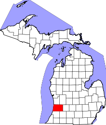 | |
| Villages | ||
| Charter township | ||
| General law townships | ||
| Unincorporated communities | ||
| Indian reservation | ||
| Footnotes | ‡This populated place also has portions in an adjacent county or counties | |