Martin's Fork (Cumberland River)
| Martins Fork | |
|---|---|
 | |
| Physical characteristics | |
| River mouth | 1,158 ft (353 m)[1] |
| Length | 32 mi (51 km) |
| Basin features | |
| Progression | Cumberland—Ohio—Mississippi |
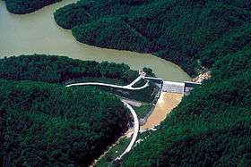
Martins Fork is a 32-mile (51 km)[2] river in Bell and Harlan Counties in Kentucky in the United States.[1] The river flows east and north from its source in the Cumberland Mountains, a subrange of the Appalachian Mountains, to its confluence with the Clover Fork at Harlan. The confluence with this into the Poor Fork at Baxter marks the official beginning of the Cumberland River.
See also
References
- 1 2 U.S. Geological Survey Geographic Names Information System: Martin's Fork (Cumberland River)
- ↑ "USGS National Atlas Streamer". United States Geological Survey. Archived from the original on 2014-05-28. Retrieved 2013-11-09.
Coordinates: 36°50′42″N 83°19′27″W / 36.84500°N 83.32417°W
This article is issued from
Wikipedia.
The text is licensed under Creative Commons - Attribution - Sharealike.
Additional terms may apply for the media files.