Maringouin, Louisiana
| Maringouin, Louisiana | |
|---|---|
| Town | |
.jpg) | |
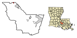 Location of Maringouin in Iberville Parish, Louisiana | |
.svg.png) Location of Louisiana in the United States | |
| Coordinates: 30°29′27″N 91°31′08″W / 30.49083°N 91.51889°WCoordinates: 30°29′27″N 91°31′08″W / 30.49083°N 91.51889°W | |
| Country | United States |
| State | Louisiana |
| Parish | Iberville |
| Government | |
| • Mayor | Demi Vorise (D) |
| Area[1] | |
| • Total | 0.74 sq mi (1.91 km2) |
| • Land | 0.74 sq mi (1.91 km2) |
| • Water | 0.00 sq mi (0.00 km2) |
| Elevation | 20 ft (6 m) |
| Population (2010) | |
| • Total | 1,098 |
| • Estimate (2016)[2] | 1,046 |
| • Density | 1,421.20/sq mi (548.60/km2) |
| Time zone | UTC-6 (CST) |
| • Summer (DST) | UTC-5 (CDT) |
| Area code(s) | 225 |
| FIPS code | 22-48610 |
Maringouin is a town in Iberville Parish, Louisiana, United States. The population was 1,098 at the 2010 census,[3] down from 1,262 at the 2000 census. It is part of the Baton Rouge Metropolitan Statistical Area.
Geography
Maringouin is located in northern Iberville Parish at 30°29′27″N 91°31′8″W / 30.49083°N 91.51889°W (30.490911, -91.519023).[4] Its northern border is the Pointe Coupee Parish line, and its eastern border is Bayou Grosse Tete. Louisiana Highway 77 passes through the center of the town, leading north 5 miles (8 km) to Livonia and southeast 6 miles (10 km) along Bayou Grosse Tete to Rosedale. Louisiana Highway 76 leads south from Maringouin 7 miles (11 km) along Bayou Maringuoin to Interstate 10 at Ramah.
According to the United States Census Bureau, Maringuoin has a total area of 0.73 square miles (1.9 km2), all of it recorded as land.[3]
Notable person
- Rick Ward III, state senator from District 17 since 2012[5]
Demographics
| Historical population | |||
|---|---|---|---|
| Census | Pop. | %± | |
| 1910 | 447 | — | |
| 1920 | 399 | −10.7% | |
| 1930 | 518 | 29.8% | |
| 1940 | 708 | 36.7% | |
| 1950 | 898 | 26.8% | |
| 1960 | 1,168 | 30.1% | |
| 1970 | 1,365 | 16.9% | |
| 1980 | 1,291 | −5.4% | |
| 1990 | 1,149 | −11.0% | |
| 2000 | 1,262 | 9.8% | |
| 2010 | 1,098 | −13.0% | |
| Est. 2016 | 1,046 | [2] | −4.7% |
| U.S. Decennial Census[6] | |||
As of the census[7] of 2000, there were 1,262 people, 421 households, and 327 families residing in the town. The population density was 1,691.3 people per square mile (649.7/km²). There were 458 housing units at an average density of 613.8 per square mile (235.8/km²). The racial makeup of the town was 20.13% White, 79.40% African American, 0.08% from other races, and 0.40% from two or more races. Hispanic or Latino of any race were 0.08% of the population.
There were 421 households out of which 40.4% had children under the age of 18 living with them, 44.7% were married couples living together, 27.6% had a female householder with no husband present, and 22.1% were non-families. 20.2% of all households were made up of individuals and 11.6% had someone living alone who was 65 years of age or older. The average household size was 3.00 and the average family size was 3.43.
In the town, the population was spread out with 33.1% under the age of 18, 9.3% from 18 to 24, 24.3% from 25 to 44, 20.2% from 45 to 64, and 13.1% who were 65 years of age or older. The median age was 32 years. For every 100 females, there were 80.8 males. For every 100 females age 18 and over, there were 73.7 males.
The median income for a household in the town was $23,816, and the median income for a family was $28,359. Males had a median income of $27,917 versus $19,500 for females. The per capita income for the town was $10,817. About 27.5% of families and 31.5% of the population were below the poverty line, including 39.2% of those under age 18 and 22.1% of those age 65 or over.
Georgetown University slavery connection
The Jesuit order which ran then Georgetown College (now Georgetown University) found the institution in financial distress in 1838. In order to repay debts, they sold 272 slaves that they owned on Maryland plantations to Southern buyers.[8][9] Many descendants of these slaves (sometimes known as the "GU272") presently live in and around Maringouin. National revelations of this connection were broken by a 2016 New York Times article.[10] A discussion is ongoing addressing the question of possible reparations from the university to the descendants of these slaves; an internal working group at Georgetown recommended that it offer "…the same consideration [they] give members of the Georgetown community in the admissions process" to the descendants.[11]
Etymology
The name, which is Cajun French in origin and means "mosquito", is pronounced mah-ring-gwin.
References
- ↑ "2016 U.S. Gazetteer Files". United States Census Bureau. Retrieved Jul 2, 2017.
- 1 2 "Population and Housing Unit Estimates". Retrieved June 9, 2017.
- 1 2 "Geographic Identifiers: 2010 Census Summary File 1 (G001): Maringouin town, Louisiana". American Factfinder. U.S. Census Bureau. Retrieved April 4, 2018.
- ↑ "US Gazetteer files: 2010, 2000, and 1990". United States Census Bureau. 2011-02-12. Retrieved 2011-04-23.
- ↑ "Senator Rick Ward, III". labi.org. Archived from the original on December 19, 2013. Retrieved July 17, 2013.
- ↑ "Census of Population and Housing". Census.gov. Retrieved June 4, 2015.
- ↑ "American FactFinder". United States Census Bureau. Retrieved 2008-01-31.
- ↑ Matthew Quallen. "Beyond the 272 Sold in 1838, Plotting the National Diaspora of Jesuit-Owned Slaves". The Hoya. Retrieved April 28, 2017.
- ↑ Noel King. "Episode 767: Georgetown, Louisiana, Part Two". Planet Money. Retrieved April 28, 2017.
- ↑ Rachel L. Swarns. "272 Slaves Were Sold to Save Georgetown. What Does It Owe Their Descendants?". The New York Times. Retrieved April 28, 2017.
- ↑ "Georgetown Shares Slavery, Memory, and Reconciliation Report, Racial Justice Steps". Retrieved April 28, 2017.
Municipalities and communities of Iberville Parish, Louisiana, United States | ||
|---|---|---|
| Cities | 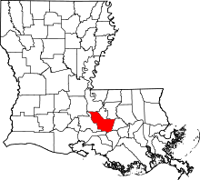 | |
| Towns | ||
| Villages | ||
| CDPs | ||
| Other unincorporated communities | ||
| Ghost towns | ||