Marble Range
| Marble Range | |
|---|---|
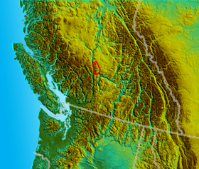 Location map of the Marble Range
| |
| Dimensions | |
| Area | 1,727 km2 (667 sq mi) |
| Geography | |
| Country | Canada |
| Province | British Columbia |
| Parent range | Interior Plateau |
The Marble Range is a small mountain range adjoining the Fraser River on the southwestern edge of the Interior Plateau of British Columbia. It has an area of 1,250 square kilometres and about 65 km NNW to SSE and about 20 km wide. Its southern flank is the north wall of Marble Canyon and the valley occupied by the ranching and First Nations community of Pavilion.
See also
References
- "Marble Range". BC Geographical Names.
- Marble Range in the Canadian Mountain Encyclopedia
Coordinates: 51°07′00″N 121°49′00″W / 51.11667°N 121.81667°W
This article is issued from
Wikipedia.
The text is licensed under Creative Commons - Attribution - Sharealike.
Additional terms may apply for the media files.