Marble Mountains (San Bernardino County)
| Marble Mountains | |
|---|---|
 | |
| Highest point | |
| Elevation | 685 m (2,247 ft) |
| Geography | |
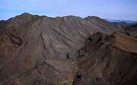
 Location of Marble Mountains in California [1] | |
| Country | United States |
| State | California |
| District | San Bernardino County |
| Range coordinates | 34°36′56.983″N 115°33′44.967″W / 34.61582861°N 115.56249083°WCoordinates: 34°36′56.983″N 115°33′44.967″W / 34.61582861°N 115.56249083°W |
| Topo map | USGS Cadiz |
The Marble Mountains are a mountain range in the Eastern Mojave Desert and within Mojave Trails National Monument, in San Bernardino County, California.[1]
Geography
The Marble Mountains are located just north of Cadiz, California, and are south of Bristol Dry Lake and Amboy, California. The Old Woman Mountains are to the east, and Bullion Mountains to the west. The Sheep Hole Mountains and Twentynine Palms, California are to the southeast.
Geology
The Marble Mountains contain excellent exposures of Paleozoic sedimentary rocks.
The Marble Mountains Fossil Beds are the site of 550 million-year-old fossils of trilobites, which were among the first animals on earth with eyes and skeletons
See also
- Mojave Trails National Monument topics
- Mountain ranges of the Mojave Desert
References
- 1 2 "Marble Mountains". Geographic Names Information System. United States Geological Survey. Retrieved 2009-05-04.
| Wikimedia Commons has media related to Marble Mountains (San Bernardino County). |
This article is issued from
Wikipedia.
The text is licensed under Creative Commons - Attribution - Sharealike.
Additional terms may apply for the media files.