Maravovo
| Maravovo | |
|---|---|
| Village | |
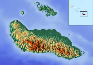 Maravovo Location in Guadalcanal | |
| Coordinates: 9°17′00″S 159°38′00″E / 9.28333°S 159.63333°ECoordinates: 9°17′00″S 159°38′00″E / 9.28333°S 159.63333°E | |
| Country |
|
| Province | Guadalcanal |
| Island | Guadalcanal |
| Time zone | UTC+11 (UTC) |
Maravovo (or alternatively Marovovo) is a village on the northwest coast of Guadalcanal, Solomon Islands. It is located 57.6 kilometres (35.8 mi) by road northwest of Honiara.[1] Mangakiki is in close proximity to Maravovo. The population is reportedly entirely Anglican.[2] On 7 October 1942, during the Guadalcanal campaign, the Japanese established a small midget submarine base there. On 7 February 1943, when the first American troops reached the area, they only encountered slight resistance, and found out most of the Japanese had already been previously evacuated during Operation Ke.[3][4][5] Wreck of one of the midget submarine still lies underwater in the bay facing the village.[6]
Notable people
- Ini Kopuria (died 1945), police officer who formed the Melanesian Brotherhood in 1925
References
- ↑ Maps (Map). Google Maps.
- ↑ Ryniker, David C (1991). Stories and Christianity in the Solomon Islands. Wichita State University. p. 20. Retrieved 26 September 2012.
- ↑ Joseph Wheelan, Midnight in the Pacific: Guadalcanal--The World War II Battle That Turned the Tide of War, 2017 https://books.google.fr/books?hl=fr&id=T7cIDgAAQBAJ&dq=marovovo&q=marovovo#v=snippet&q=marovovo&f=false%7C
- ↑ https://www.pacificwrecks.com/provinces/solomons_guadalcanal_maravovo.html
- ↑ http://www.combinedfleet.com/Solomons.htm
- ↑ Ewan Stevenson. https://www.pacificwrecks.com/subs/HA-11.html
This article is issued from
Wikipedia.
The text is licensed under Creative Commons - Attribution - Sharealike.
Additional terms may apply for the media files.