Mankins, Texas
| Mankins, Texas | |
|---|---|
| Unincorporated community | |
 Mankins Location within the state of Texas  Mankins Mankins (the US) | |
| Coordinates: 33°46′56″N 98°47′50″W / 33.78222°N 98.79722°WCoordinates: 33°46′56″N 98°47′50″W / 33.78222°N 98.79722°W | |
| Country | United States |
| State | Texas |
| County | Archer |
| Elevation | 1,112 ft (339 m) |
| Population (2000) | |
| • Total | 10 |
| Time zone | UTC-6 (Central (CST)) |
| • Summer (DST) | UTC-5 (CDT) |
| GNIS feature ID | 1362131[1] |
Mankins is an unincorporated community located at the intersection of U.S. Highway 82, U.S. Highway 277, and Texas State Highway 25 in Archer County, Texas, United States, 18 miles northwest of Archer City, the county seat of Archer County. Mankins is located within the Wichita Falls Metropolitan Statistical Area.
Description
The area was settled around 1889. In 1890, the Wichita Valley Railway came through. The town was named after Tom Mankins, who was the foreman for the nearby Lazarus Ranch. In 1909, a post office opened. By 1914, around 55 people resided in the area. Oil was discovered in the 1920s. In 1938, a tornado came through town and destroyed the school. By 1950, the population rose to 120. The post office closed in 1963.[2]
References
Municipalities and communities of Archer County, Texas, United States | ||
|---|---|---|
| Cities | 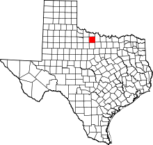 | |
| Towns | ||
| Unincorporated Communities | ||
| Ghost towns | ||
| Footnotes | ‡This populated place also has portions in an adjacent county or counties | |
This article is issued from
Wikipedia.
The text is licensed under Creative Commons - Attribution - Sharealike.
Additional terms may apply for the media files.