Manirang
| Manirang | |
|---|---|
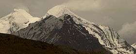 Manirang peak from NW direction | |
| Highest point | |
| Elevation | 6,593 m (21,631 ft) [1] |
| Prominence | 1,727 m (5,666 ft) [1] |
| Listing | Ultra |
| Coordinates | 31°57′12″N 78°22′00″E / 31.95333°N 78.36667°ECoordinates: 31°57′12″N 78°22′00″E / 31.95333°N 78.36667°E [1] |
| Geography | |
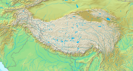 Manirang Tibetan Plateau | |
| Location | Himachal Pradesh, India |
| Parent range | Himalaya |
| Climbing | |
| First ascent | 1952, Dr. J. de V. Graaff[2] |
Manirang is one of the highest mountains in the Indian state Himachal Pradesh. It lies on the border between Kinnaur district and Lahaul and Spiti district. Close to the peak is the high Manirang pass, which was one of the early trade routes between Spiti and Kinnaur, before the motorable road was built.
See also
References
- 1 2 3 "High Asia I: The Karakoram, Pakistan Himalaya and India Himalaya (north of Nepal)". Peaklist.org. Retrieved 2014-05-28.
- ↑ Harish Kapadia, High Himalaya Unknown Valleys, fourth edition (Indus Publishing Company, New Delhi, 2001) ISBN 81-7387-117-5
This article is issued from
Wikipedia.
The text is licensed under Creative Commons - Attribution - Sharealike.
Additional terms may apply for the media files.