Maniitsoq Island
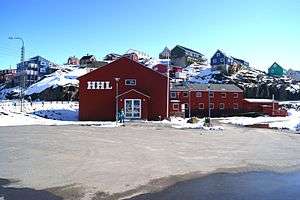 View of Maniitsoq town | |
 Maniitsoq Island | |
| Geography | |
|---|---|
| Location | Davis Strait |
| Coordinates | 65°28′00″N 52°59′00″W / 65.46667°N 52.98333°WCoordinates: 65°28′00″N 52°59′00″W / 65.46667°N 52.98333°W |
| Highest elevation | 216 m (709 ft) |
| Administration | |
|
Greenland | |
| Municipality | Qeqqata |
| Demographics | |
| Population | 2670 (2013)[1] |
Maniitsoq Island is an island in the Qeqqata municipality in western Greenland.[2]
Geography
The island is located on the shores of Davis Strait, separated from Sermersuut Island in the north by the Ammarqoq Sound. The island is roughly triangular in shape and many little islets and rocks dot its eastern and southwestern coastline.[3]
Located at the southern end of the island, Maniitsoq was formerly known as Sukkertoppen.[4] It is the only settlement in the area and is served by the Maniitsoq Airport.
See also
References
- ↑ Greenland in Figures 2013 (PDF). Statistics Greenland. ISBN 978-87-986787-7-9. ISSN 1602-5709. Retrieved 5 September 2013.
- ↑ Maniitsoq, Saga Map, Tage Schjøtt, 1992
- ↑ Maniitsoq
- ↑ Ross, James. Narrative of a Second Voyage in Search of a North-west Passage, and of a Residence in the Arctic Regions During the Years 1829, 1830, 1831, 1832, 1833. A.W. Webster, 1835.
External links

- Air Greenland - Maniitsoq
This article is issued from
Wikipedia.
The text is licensed under Creative Commons - Attribution - Sharealike.
Additional terms may apply for the media files.